About Me · Landscape design · Project management

Landscape design, from idea to site.

CurrentlySenior Landscape Designer / Project ManagerArcadis · Toronto

I’m Mengfan Sha, a Toronto-based landscape designer and project manager with over eight years of experience. My work spans design, team coordination, and construction administration.

I’m Mengfan Sha, a Toronto-based landscape designer and project manager with over eight years in public space, infrastructure, and sustainability research. I develop design proposals and work with clients, consultants, and contractors, managing technical requirements, budgets, schedules, and changes through construction and closeout.

  • Concept & design development
  • Consultant coordination
  • Construction & closeout
Experience

My work so far.

For more than eight years, I’ve worked in landscape architecture, urban design, and sustainability research in Canada, the United States, and internationally. My roles have covered design, coordination across disciplines, and project delivery.

MLA
Harvard University
BA
Architecture, University of Toronto
LEED AP
OALA registration in progress
PMP in progress
ArcadisSenior Landscape Designer / Project Manager · Toronto

Manage landscape and public-space projects from early design through construction and warranty closeout.

  • Plan deliverables and review milestones. Track schedules and project budgets, and prepare forecasts.
  • Review additional scope and prepare service proposals. Document changes and their implications for the budget, schedule, and team’s responsibilities.
  • Coordinate with architects, engineers, utilities, BIM and security teams, sustainability specialists, clients, agencies, and contractors to resolve requirements affecting the landscape work.
  • Prepare construction drawings and coordinate package reviews. Follow up on review comments and missing information before issue.
  • Carry out contract administration and site reviews. Document field conditions in site reports and project records, and follow up on construction issues and planting replacements through warranty closeout.
  • Co-develop a carbon modelling tool that helps project teams compare the carbon impacts of materials and nature-based design options.
Dynamic Carbon ModelDavid Crombie ParkOntario Line NorthOrbit MasterplanWoodbine DevelopmentMOEGGhaf WoodsVMCSix Senses
HOKUrban Designer / Landscape Designer · Toronto

Worked on landscape and public-space design for civic, institutional, and urban projects.

  • Developed site, landscape, and streetscape concepts through analysis, design studies, models, drawings, and visualizations.
  • Coordinated public-space design with building layouts, circulation, grading, accessibility, and technical requirements across the consultant team.
  • Supported design development and documentation for public and cultural projects.
  • Contributed to stakeholder meetings, board discussions, and public outreach for Centrus. Worked through design feedback across multiple stages of review.
Centrus Parliamentary Precinct RenewalCivic landscape design
Agence TerLandscape Designer · Los Angeles

Worked on public-space projects, from site-wide planning to pedestrian routes and landscape details.

  • Prepared landscape and public-space concepts using plans, sections, diagrams, 3D studies, and renderings.
  • Tested ideas for parks, civic spaces, walking routes, and open space, with attention to ecology, access, and how uses could change over time.
  • Prepared competition and client presentations to explain design ideas and support project reviews.
  • Helped write the team’s proposal for the Silver Lake Reservoir Master Plan.
  • Helped present and discuss design proposals with local communities through outreach and public engagement.
Silver Lake Reservoir RenewalPershing SquareJanuary 8th MemorialPublic-space competitions
Plant Architect Inc.Intern · Toronto

Supported design research, drawings, visualizations, and project development in a studio working across architecture and landscape.

Design researchDrawing & visualizationStudio collaboration
Reed HilderbrandIntern · Boston

Contributed to landscape design studies and visualizations in a practice working with cultural landscapes, ecology, and material details.

Landscape studiesSite analysisDesign representation
Public WorkIntern · Toronto

Supported public-space and landscape design work in a collaborative studio focused on cities and infrastructure.

Public realmUrban landscapeCollaborative design
Selected work · 2018—2026

Selected projects.

Nine projects from my work in landscape design, infrastructure, and carbon research. Each includes the project background, my role, and examples of the work.

In Canada

4 projects
01 · Arcadis · Toronto

Ontario Line — Minton Place Tunnel Portal & Emergency Exit Building

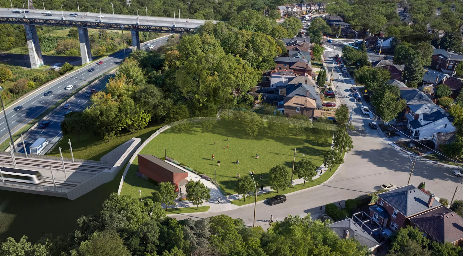
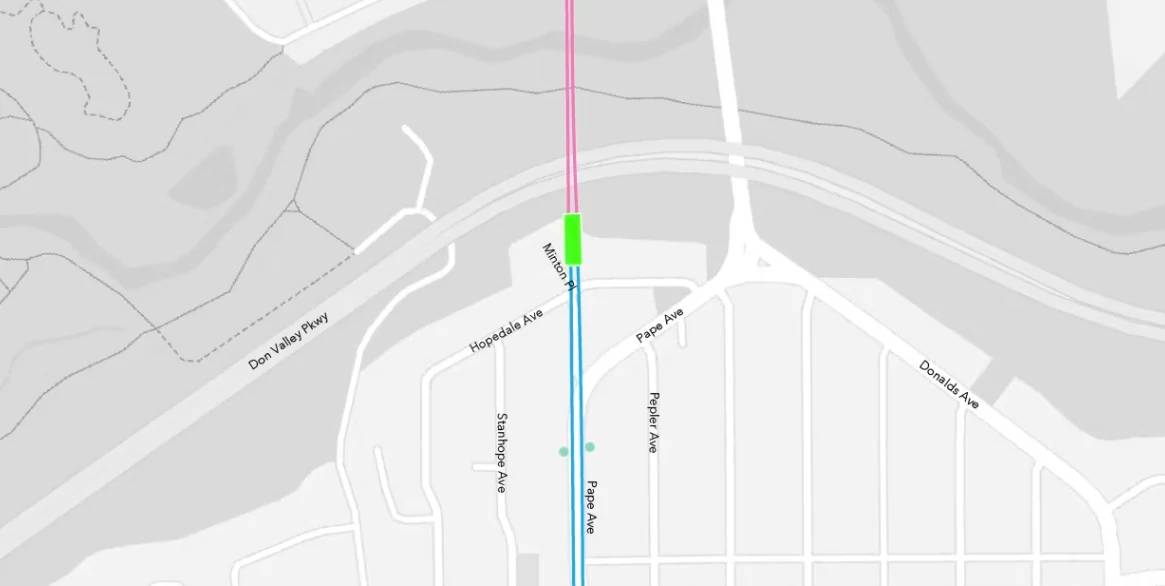
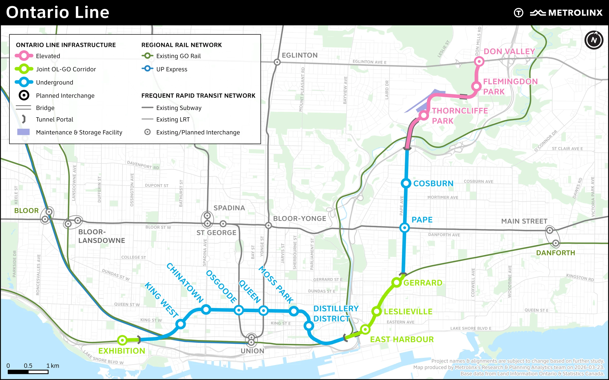
The Ontario Line is a planned 15.6-kilometre subway with 15 stations across Toronto. At Minton Place, trains transition between underground tunnels and the elevated guideway; the site also includes an emergency exit building and a future community parkette above the portal.

Location
Minton Place, Toronto, Ontario
Role
Minton Place Landscape Design Lead · Package Coordinator
Period
2025–Present
Project status

90% construction documents (CD) · IFC issuance targeted for 2027My contribution: Minton Place landscape design and package coordination from 50% design development (DD) through 90% CD; ongoing.

Aerial rendering of the future Minton Place tunnel portal, emergency exit building, and community parkette
Aerial visualization of the future portal site, emergency exit building, and community parkette at Minton Place.
MoreLess
My role and contribution

I lead landscape design for the Minton Place tunnel portal, emergency exit building, and future parkette. The design has to account for local streets, utilities, security requirements, and the surrounding neighbourhood.
As Package Coordinator for Minton Place, I coordinate inputs from architecture, civil, structural, electrical, utilities, security, BIM, and City teams. I track reviews and comments, record assumptions and dependencies, and follow up on consultant responses.

Public project information

The project overview above is summarized from Metrolinx’s publicly available project pages.

Portfolio notice. Project background comes from the linked public sources. Materials illustrate my contribution, without implying sole authorship. They are not official or complete project documents. Rights remain with Arcadis and the relevant project parties. Source credits apply. Display here does not grant reuse permission. Contact the project owner or rights holder for approved documents, current information, or reuse permissions.

02 · City of Toronto · SLA + Arcadis

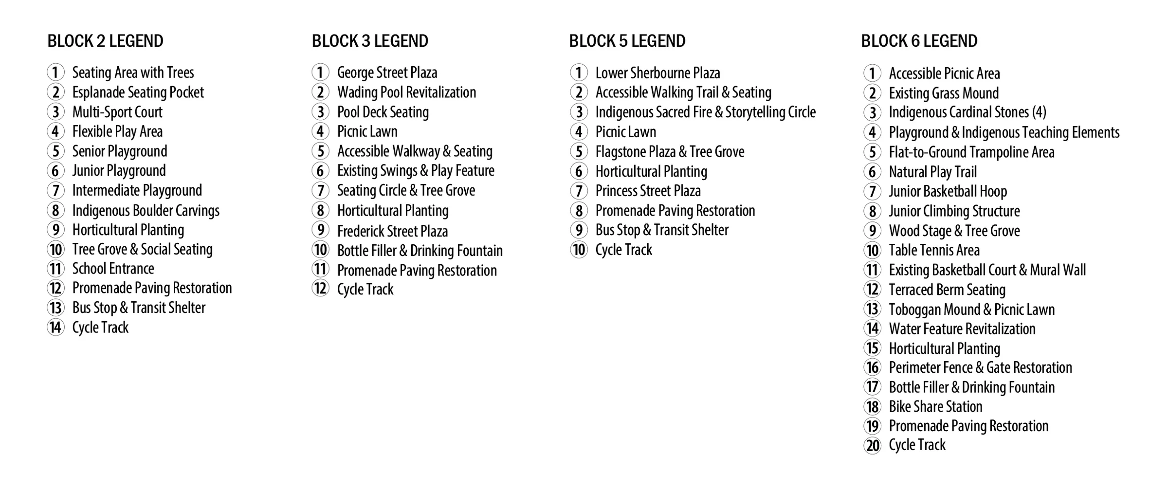
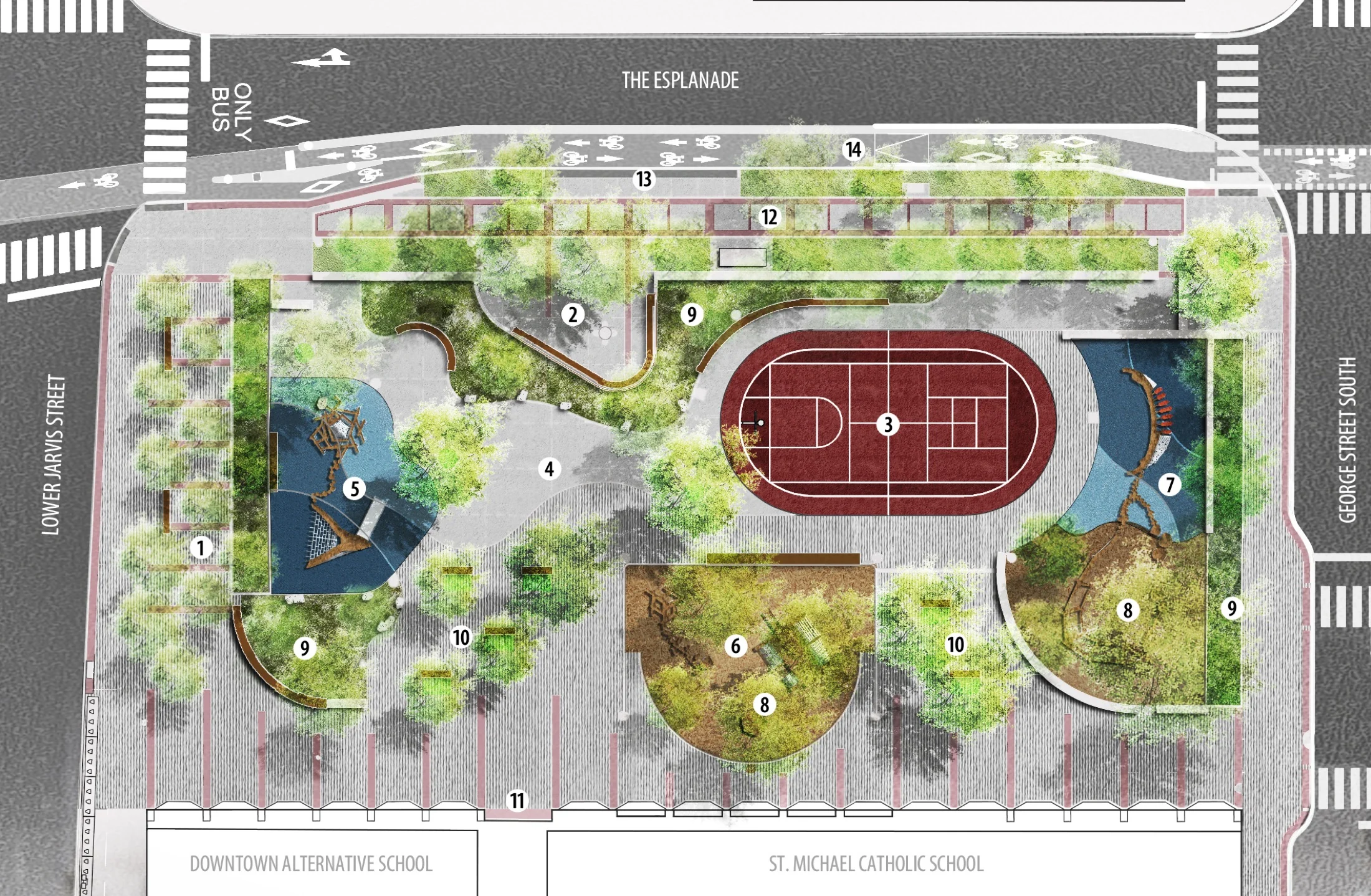
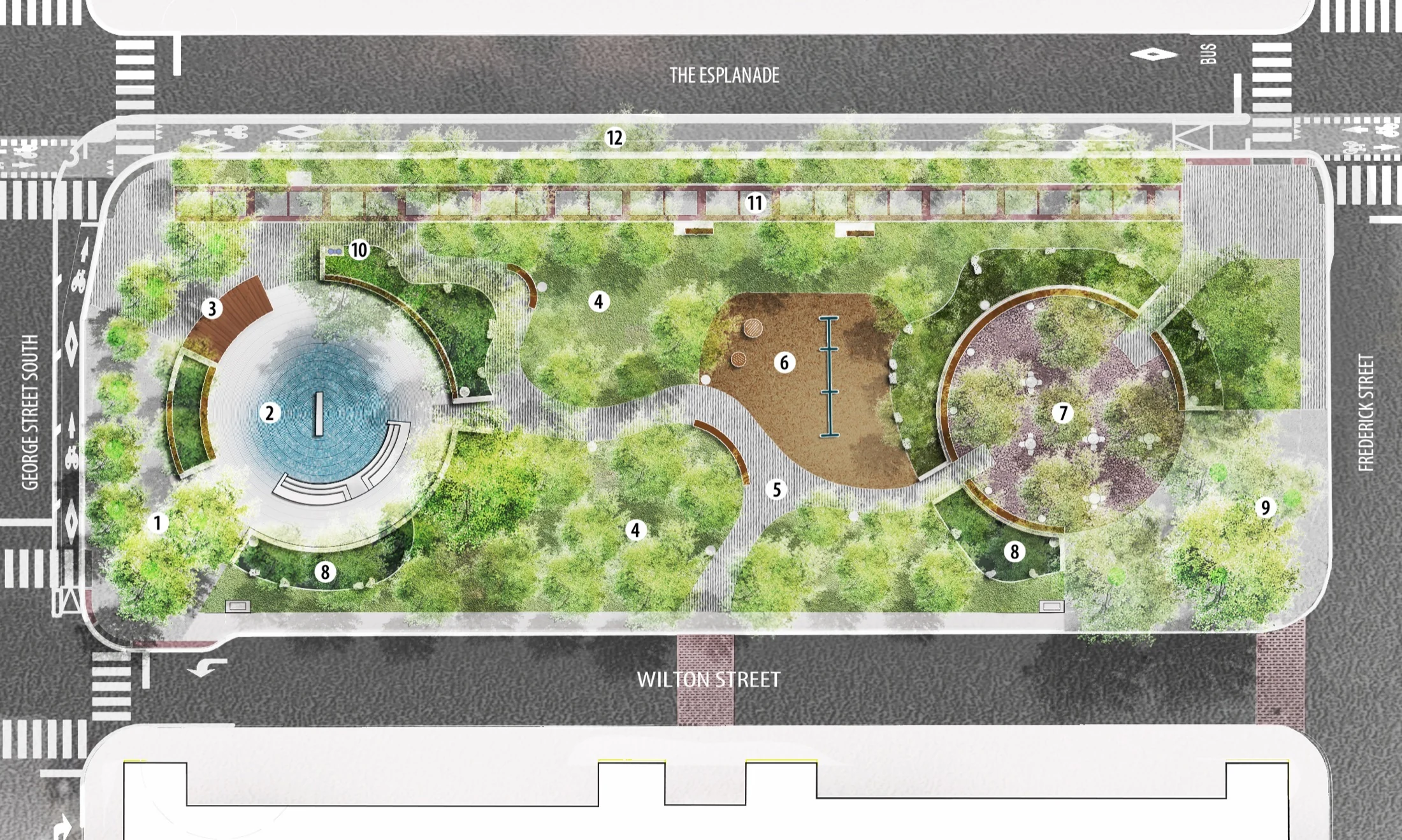
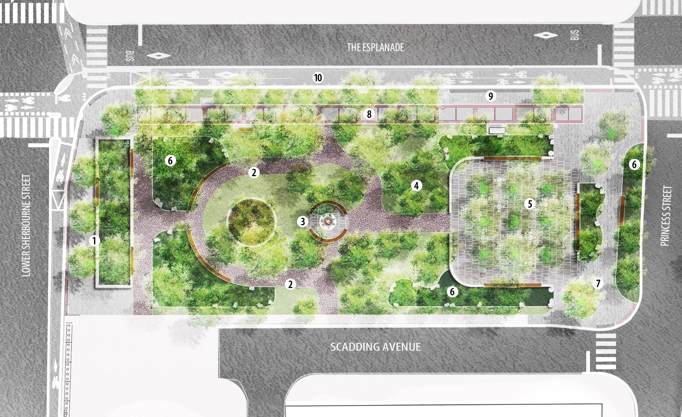
David Crombie Park Revitalization

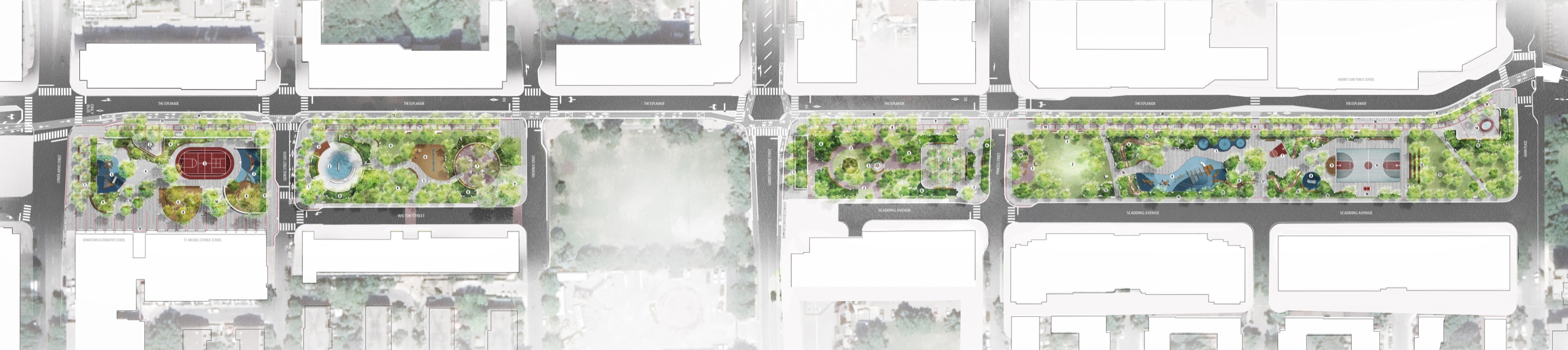
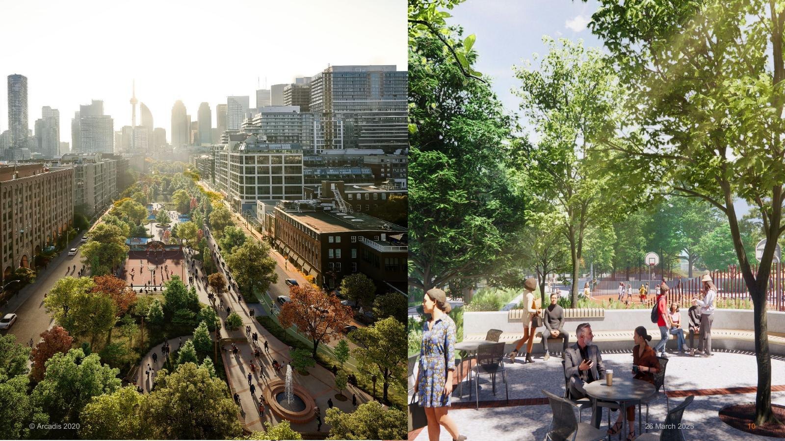
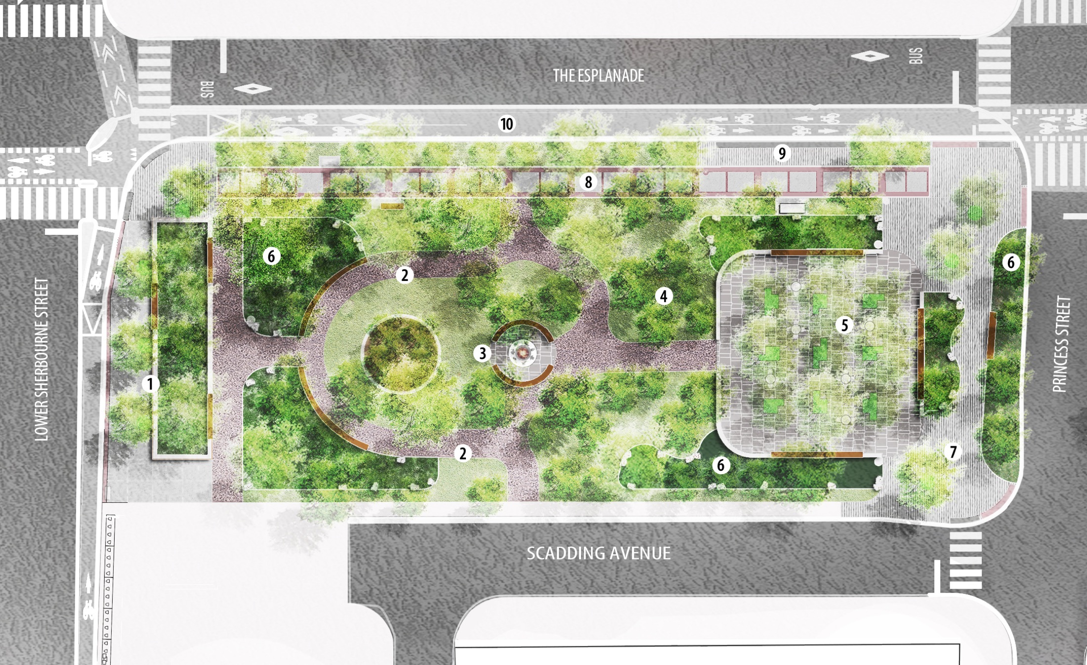
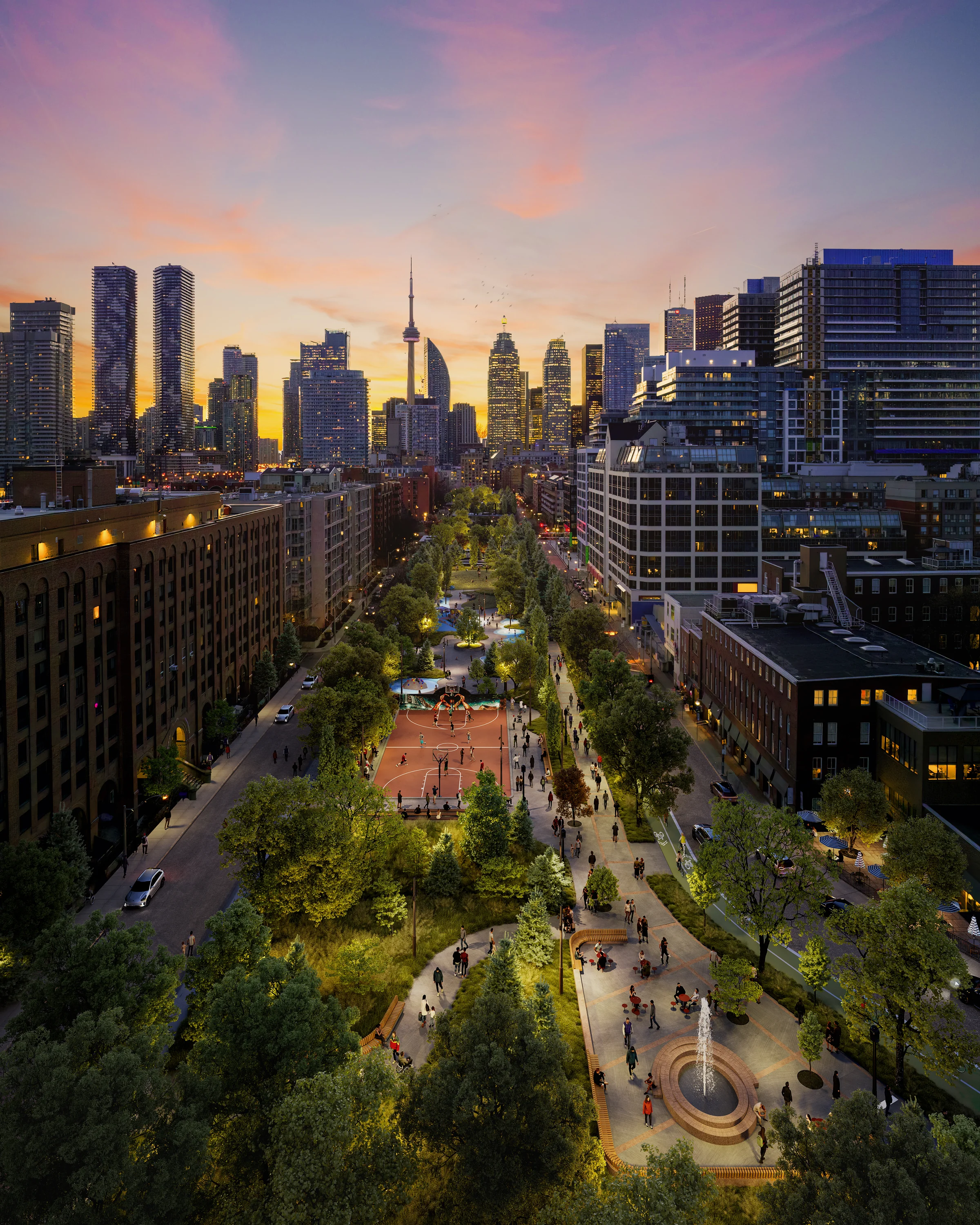
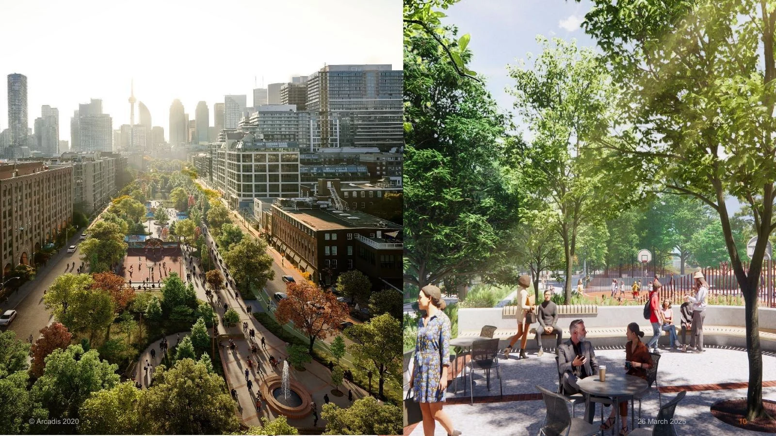
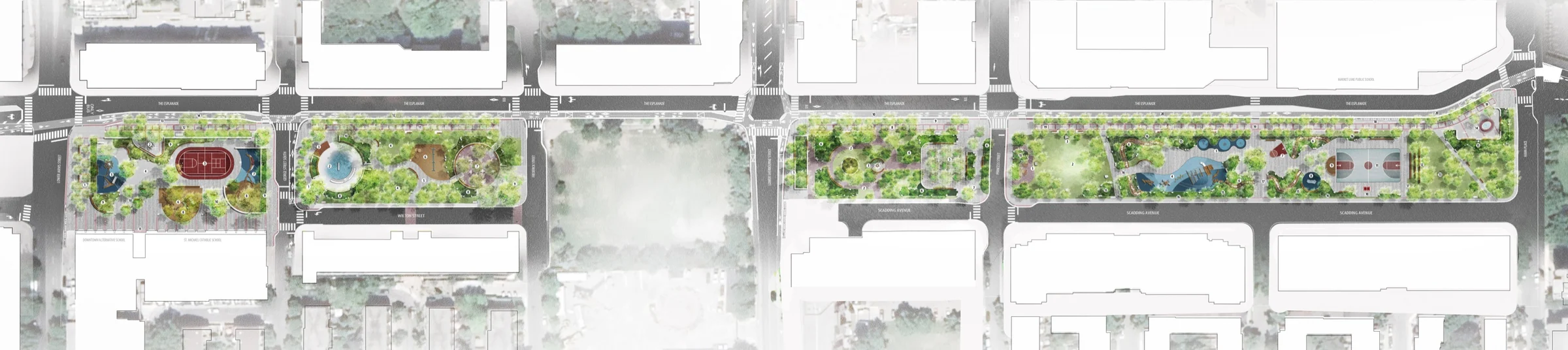
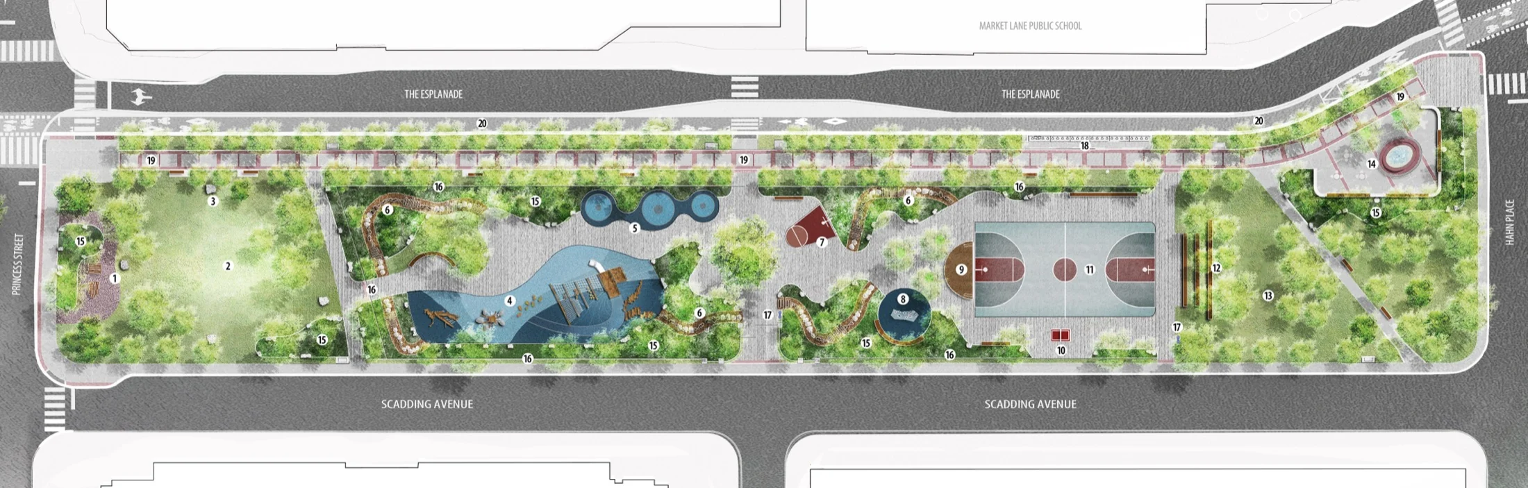
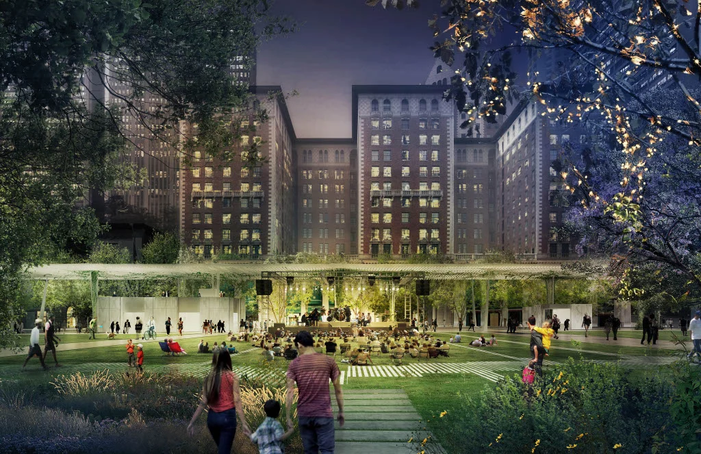
David Crombie Park is a seven-block linear park in Toronto’s St. Lawrence neighbourhood. SLA and Arcadis’s renewal retains existing park features while improving access, planting, and places to gather. It also connects the park with The Esplanade and new cycling infrastructure, with carbon analysis informing design choices.

Location
Toronto, Ontario
Role
Sustainability Specialist · Project Designer
Period
c. 2024–2026
Project status

Issued for Construction (IFC) · Construction phaseMy contribution: Tender documentation, sustainability reporting, and Dynamic Carbon Model analysis.

Dusk aerial visualization of David Crombie Park with illuminated public spaces and the Toronto skyline
MoreLess
My role and contribution

I worked as Sustainability Specialist and Project Designer on the 1.6-kilometre park and cycle-track renewal. I was responsible for Dynamic Carbon Model (DCM) analysis and rendering. The carbon studies informed material choices and construction decisions; the renderings helped explain the landscape proposals. The work also had to meet accessibility, heritage, public-space, and infrastructure requirements.

I worked with City staff, councillors, and community stakeholders on renewal priorities, sustainability goals, and Toronto Green Standard requirements. This involved applying the research to design choices and implementation.

Public project information

The park links housing, schools, community facilities, and other local destinations. The renewal adapts existing infrastructure, adds planting, improves walking connections, and integrates cycling along The Esplanade. Tawaw Architecture Collective developed the Indigenous placekeeping elements.

Construction Canada’s 2023 article explains how Arcadis’s Dynamic Carbon Model was used to assess emissions and carbon sequestration for the design. The proposal later received the jury award and People’s Choice recognition in the Urban Design — Unbuilt Developments category at the 2026 AZ Awards. These awards recognize the proposal; the carbon figures are design projections, not measured results from a completed park.

Portfolio notice. Project background comes from the linked public sources. Materials illustrate my contribution, without implying sole authorship. They are not official or complete project documents. Rights remain with SLA, Arcadis, the City of Toronto, and the relevant project parties. Source credits apply. Renderings show the design proposal. Original image attribution applies. Display here does not grant reuse permission. Contact the project owner or rights holder for approved documents, current information, or reuse permissions.

03 · Toronto · Arcadis

Woodbine Block 9 — Woodbine Square

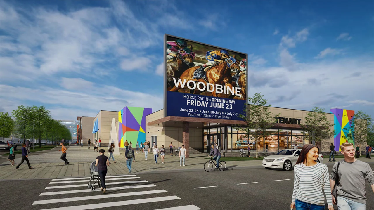
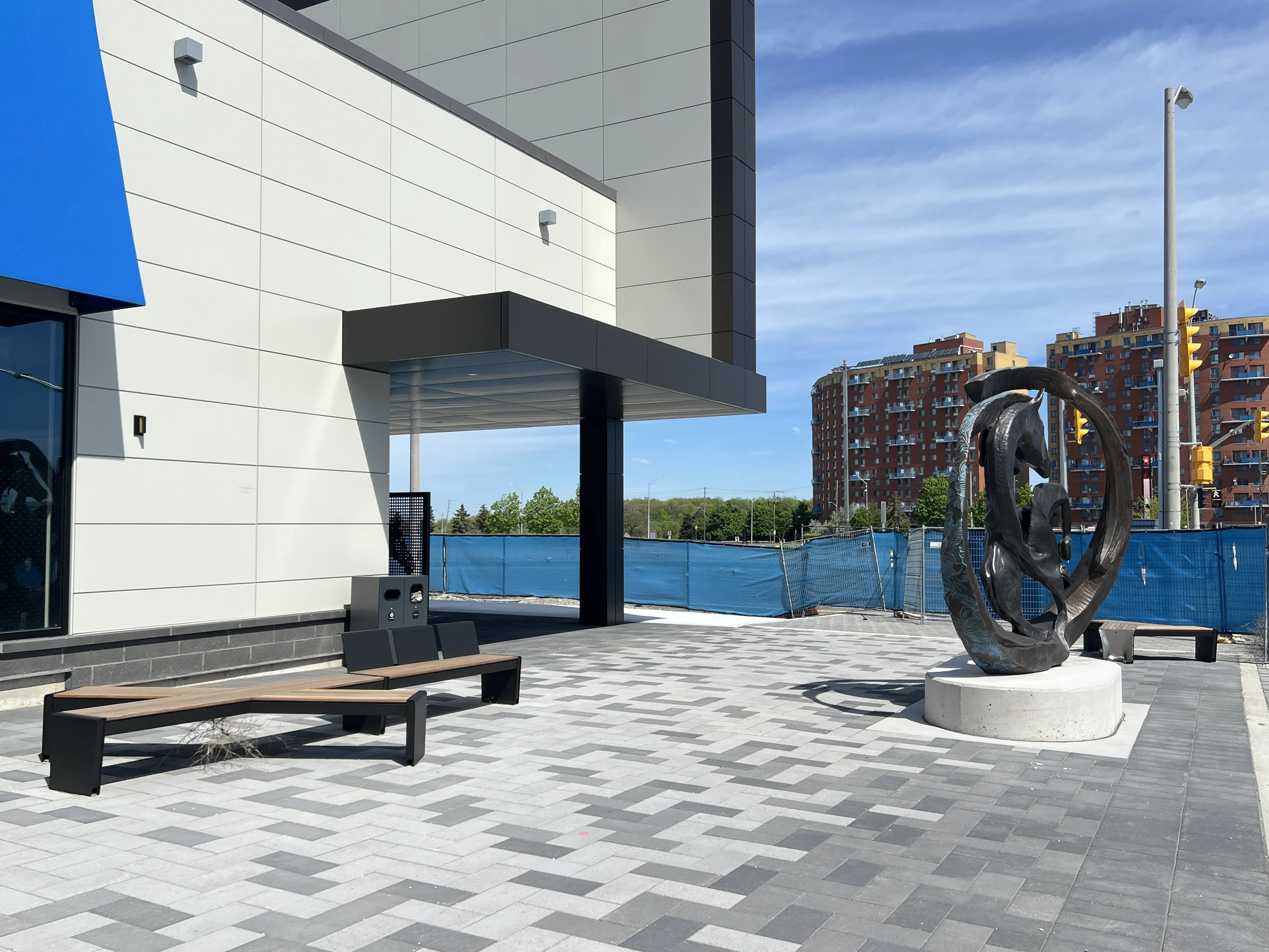
Block 9 is part of the Phase 1 redevelopment of the Woodbine lands in Etobicoke. Shared streets, planting, and places to sit and gather connect the retail and entertainment buildings. The landscape is designed around people walking through and spending time in the district.

Location
555 Rexdale Boulevard, Etobicoke, Toronto
Role
Project Designer · Primary Landscape Coordinator
Period
c. 2022–2026
Project status

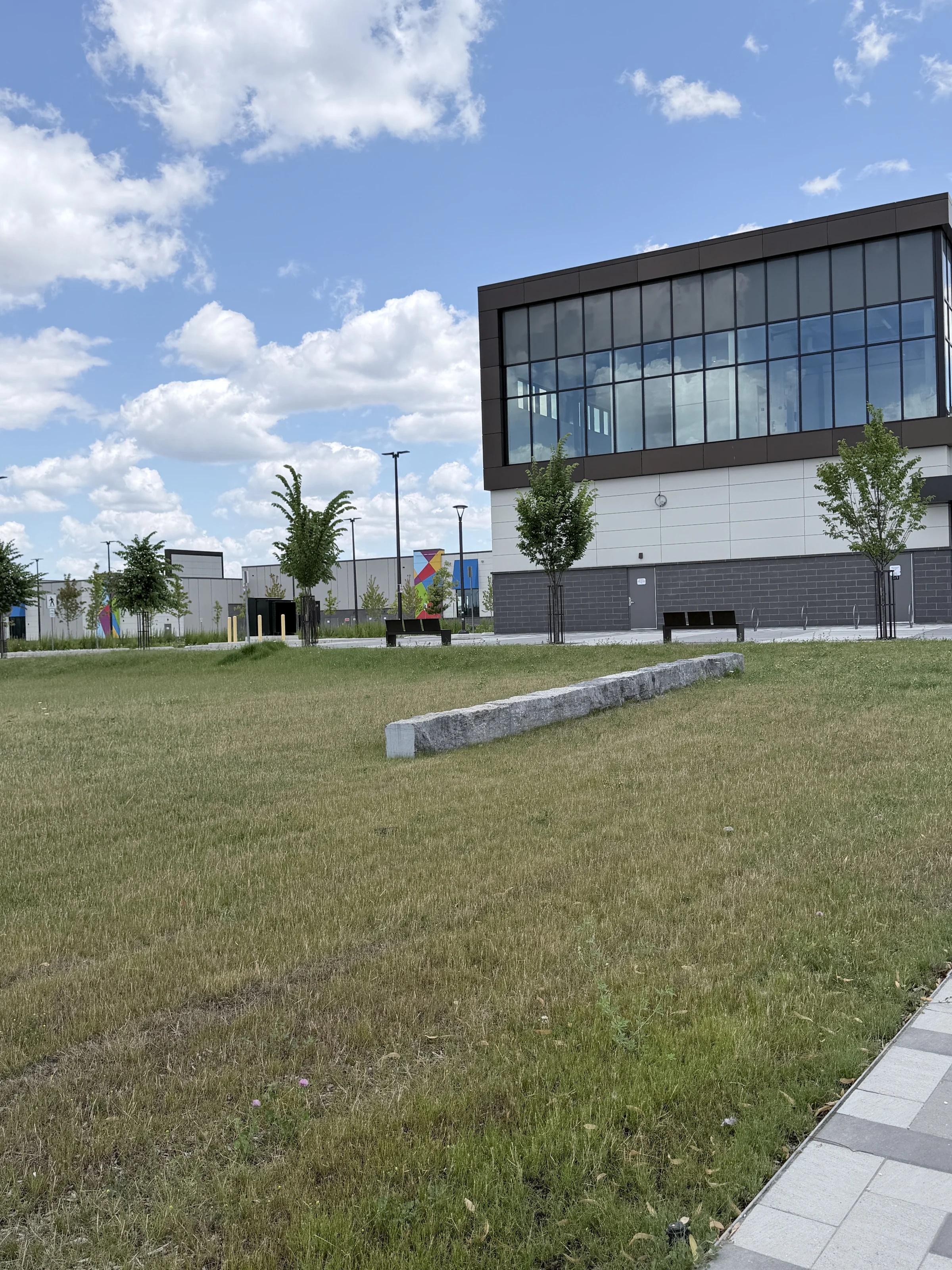
Warranty closeout completeMy contribution: Primary landscape coordination from 50% DD through tender, IFC, construction administration, and warranty closeout.Occupied October 2023 · Post-occupancy planting replacements and documentation completed through warranty closeout

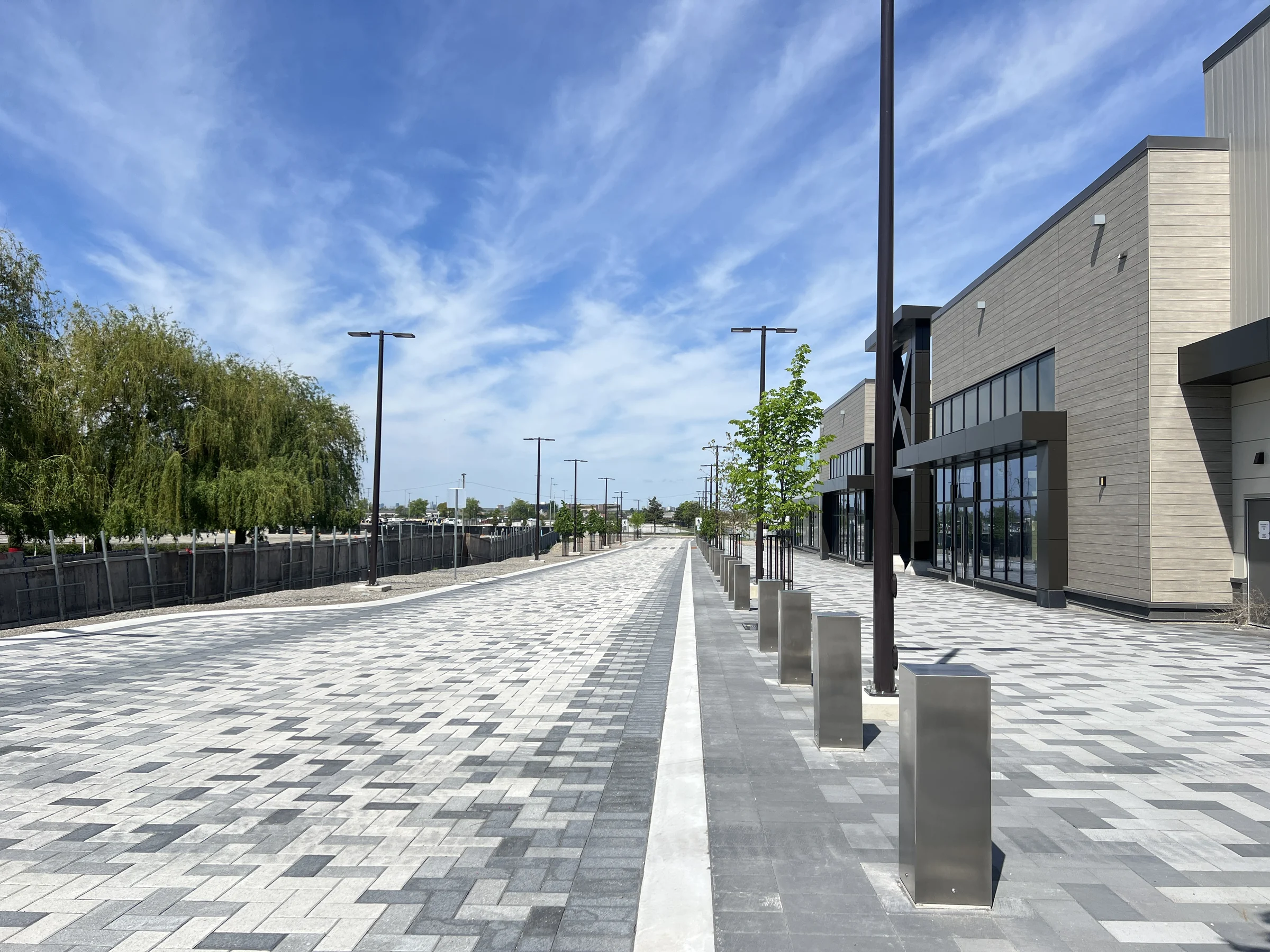
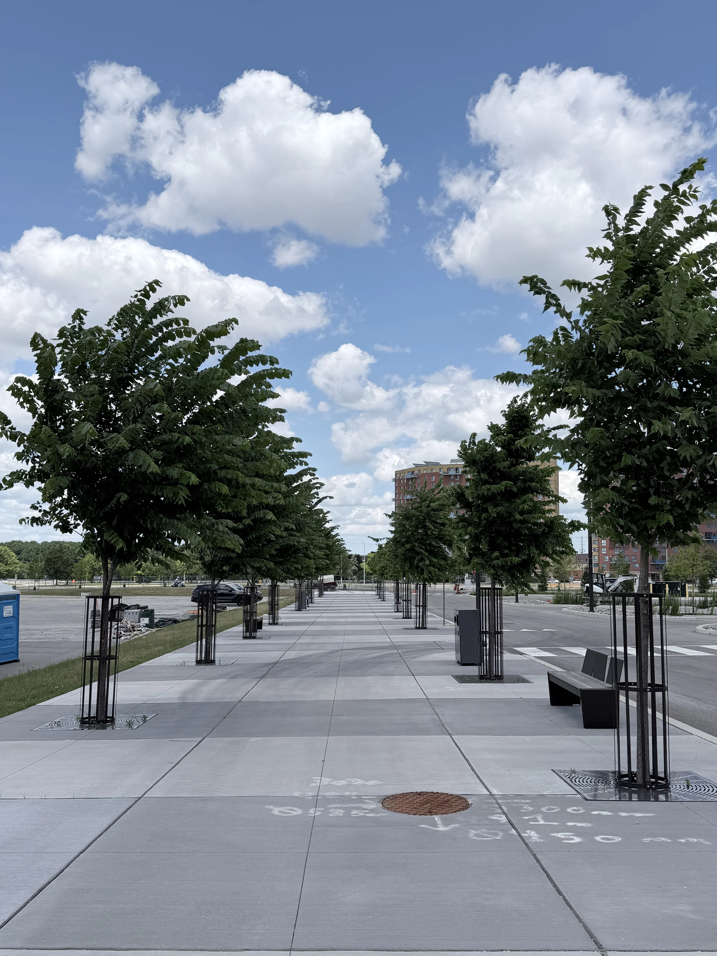
Completed Woodbine Block 9 streetscape with patterned paving, pedestrian space and retail frontages
MoreLess
My role and contribution

As the primary landscape coordinator for Block 9, I independently handled the package from 50% design development (DD) through tender and issued-for-construction (IFC) documentation. My responsibilities continued through construction administration and warranty closeout.

Responsibilities and delivery

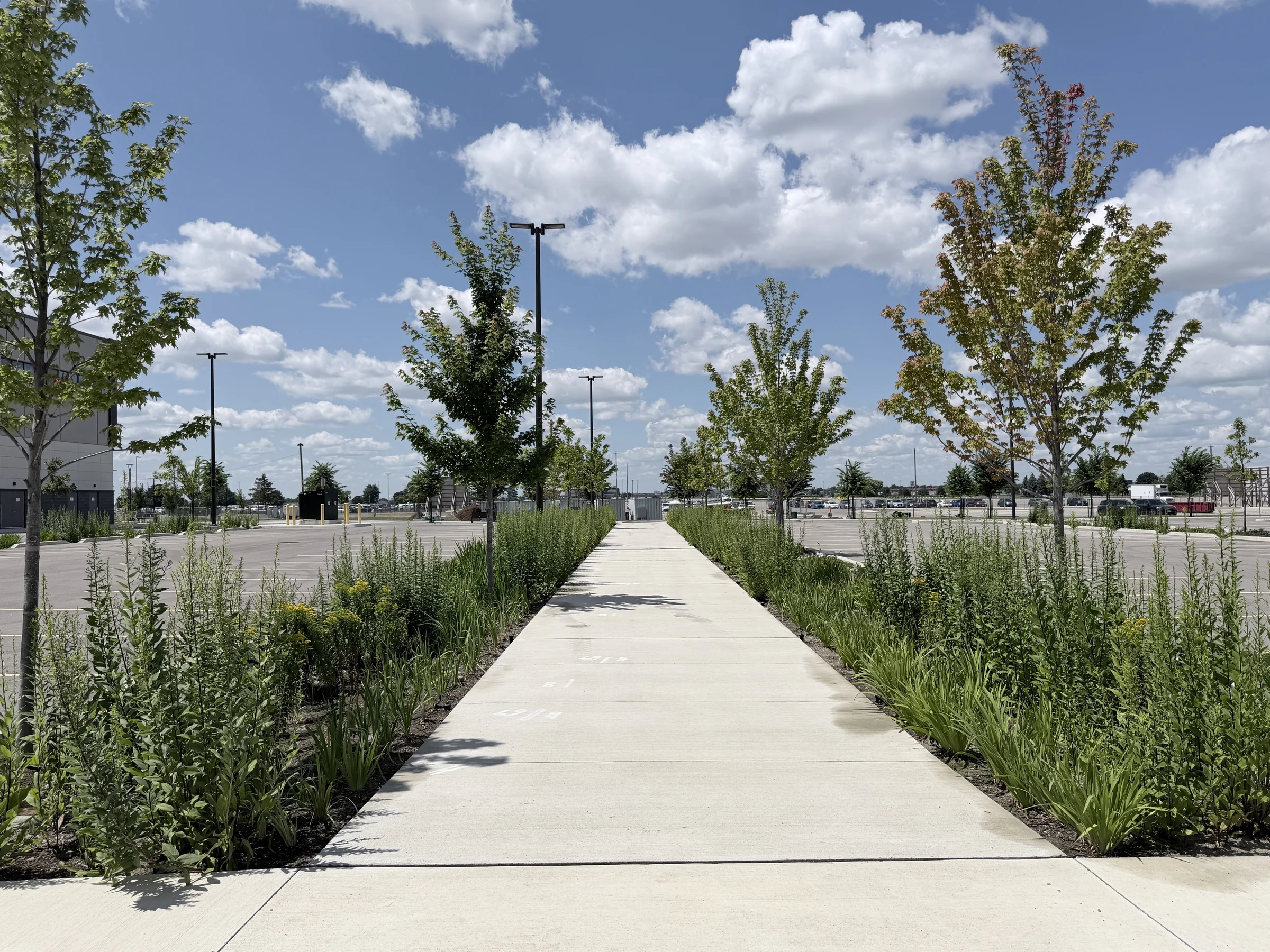
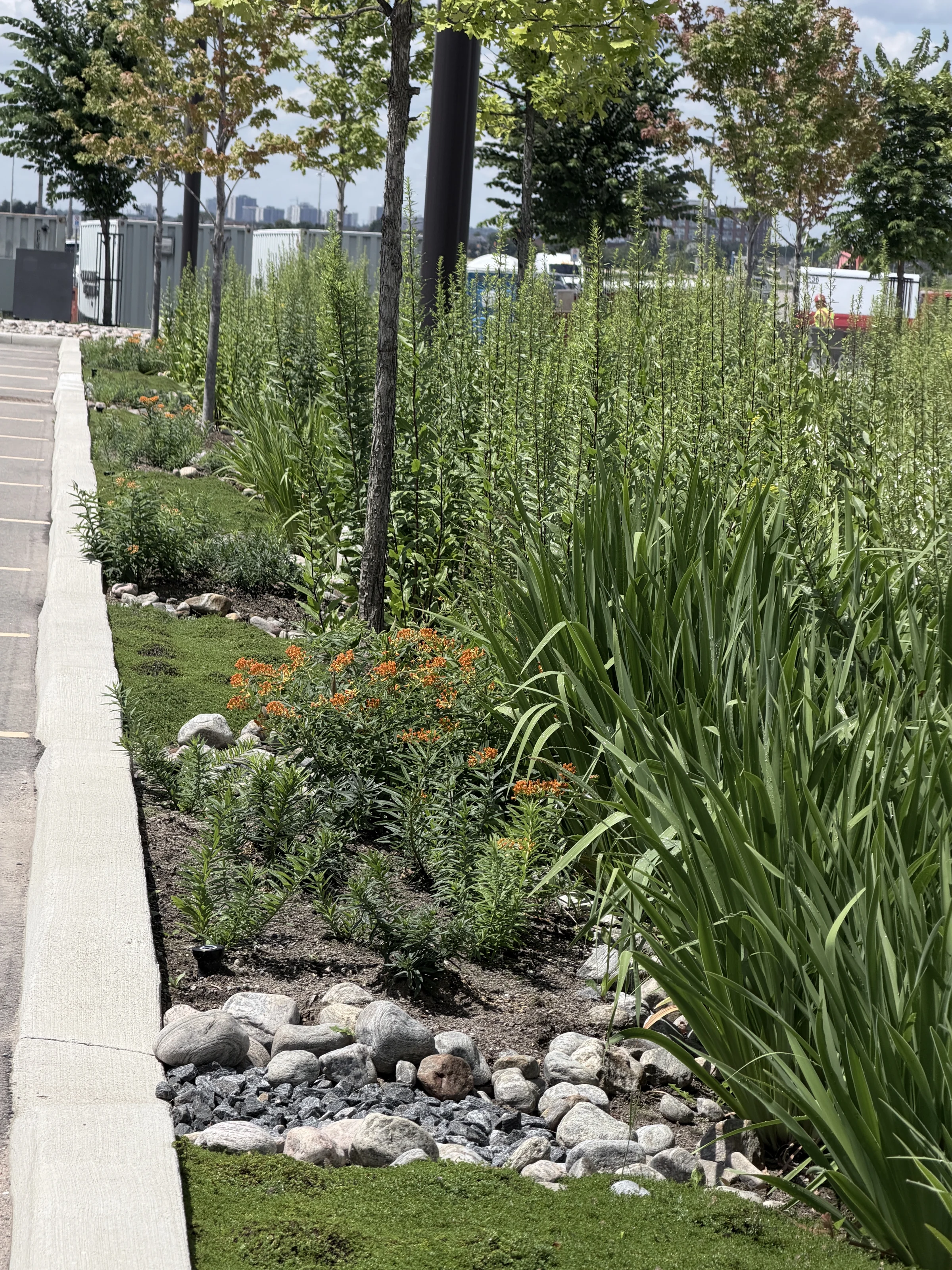
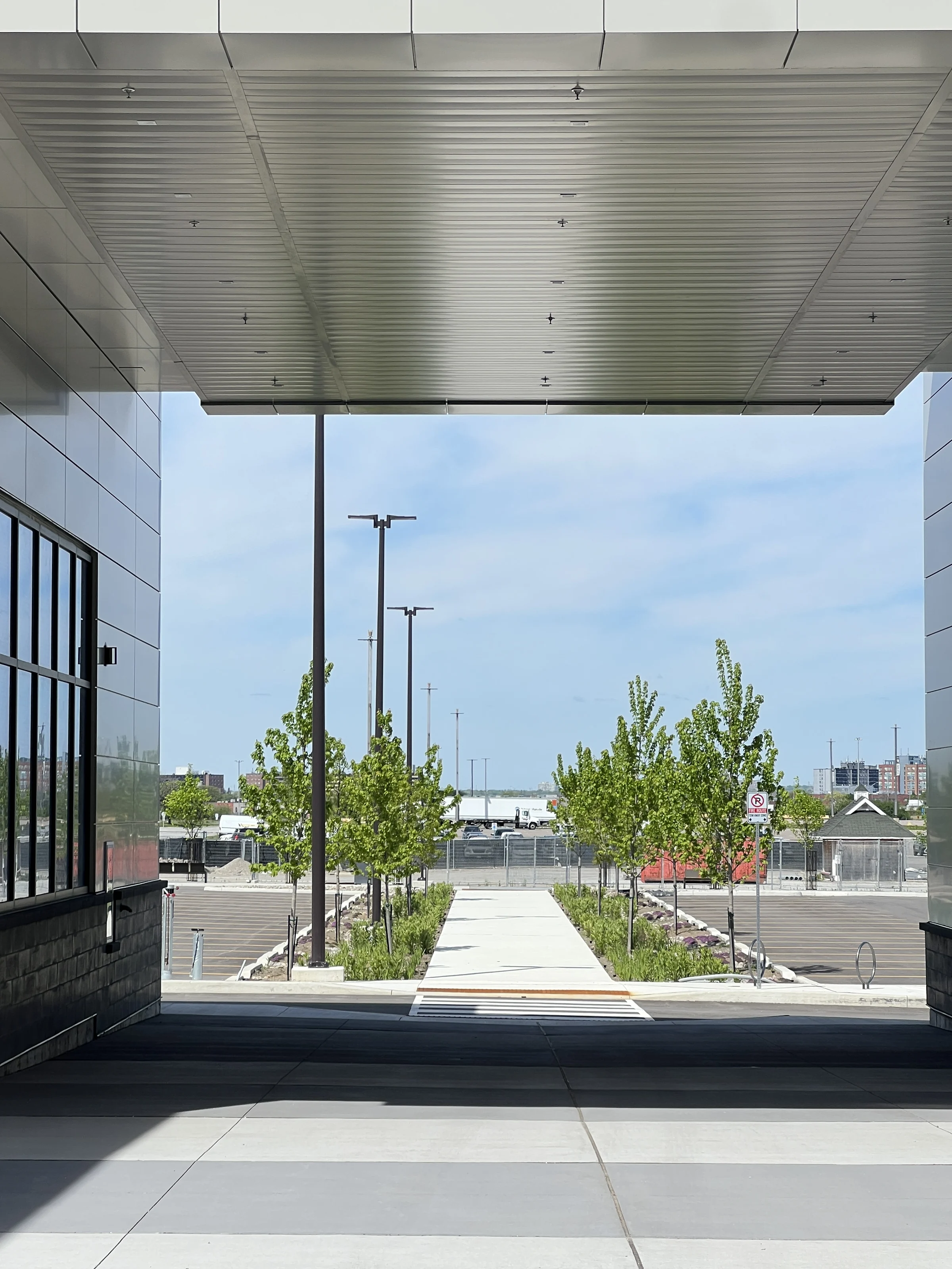
I prepared and coordinated construction drawings, handled landscape contract administration and RFIs, and carried out site reviews and reporting. I followed up with consultants and contractors on site issues. After occupancy in October 2023, I remained responsible for planting replacements, the related records, and outstanding landscape items through warranty closeout. The design included parametric paving patterns and bioswale planting coordinated with drainage and parking-lot infrastructure.

Working with change

I tracked how design and site changes affected the budget, reviewed value-engineering options, and coordinated landscape change orders. I also reviewed additional scope and prepared fee proposals, setting out the deliverables and their effect on budget and schedule.

Public project information

UrbanToronto’s coverage describes the wider Woodbine Racetrack redevelopment, including its retail and public spaces, and lists Arcadis as landscape architect. The links provide background on the development. My role described here relates to Block 9.

Portfolio notice. Project background comes from the linked public sources. Materials illustrate my contribution, without implying sole authorship. They are not official or complete project documents. Rights remain with Arcadis, Woodbine Entertainment, the credited architects, and their respective rights holders. Source credits apply. Public renderings are sourced from UrbanToronto; the streetscape rendering is credited there to WZMH Architects for Woodbine Entertainment / One Toronto Gaming. Concept images may show an earlier design stage. Display here does not grant reuse permission. Contact the project owner or rights holder for approved documents, current information, or reuse permissions.

04 · Ottawa · HOK

Centrus — Parliamentary Precinct Renewal

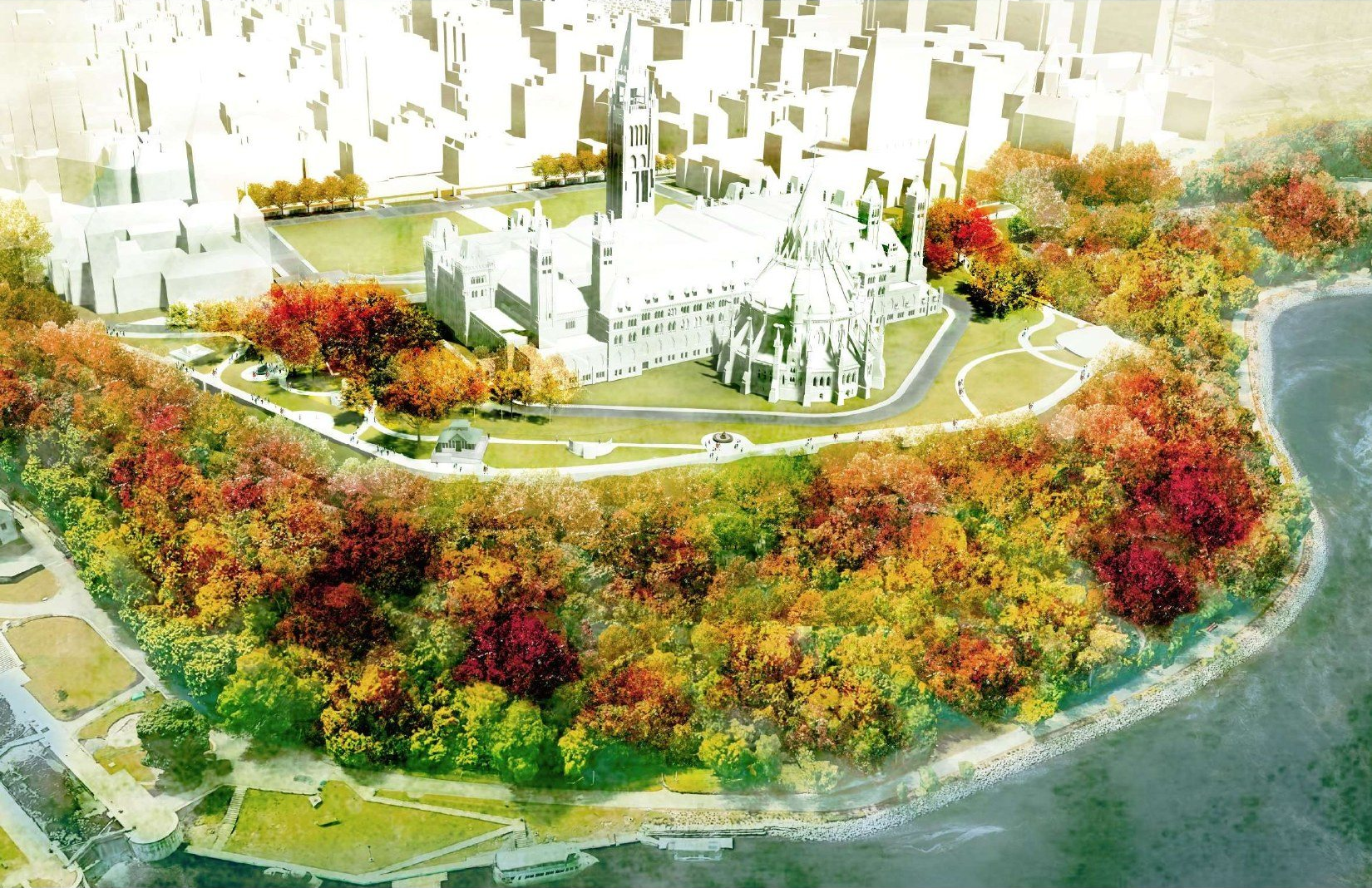
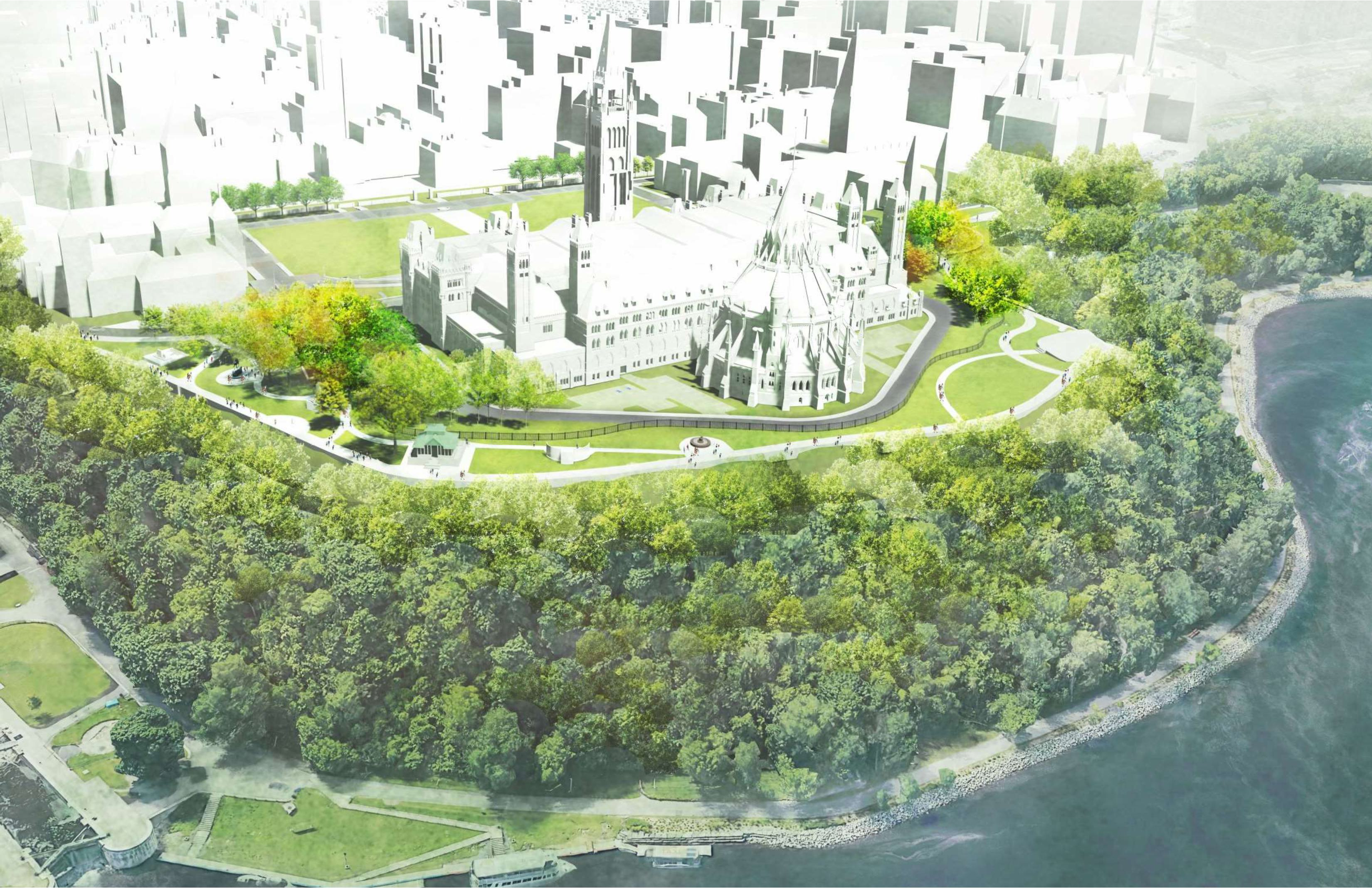
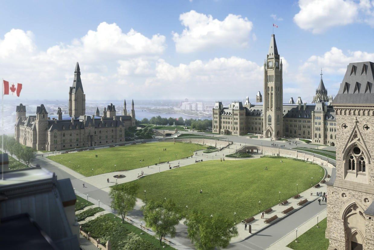
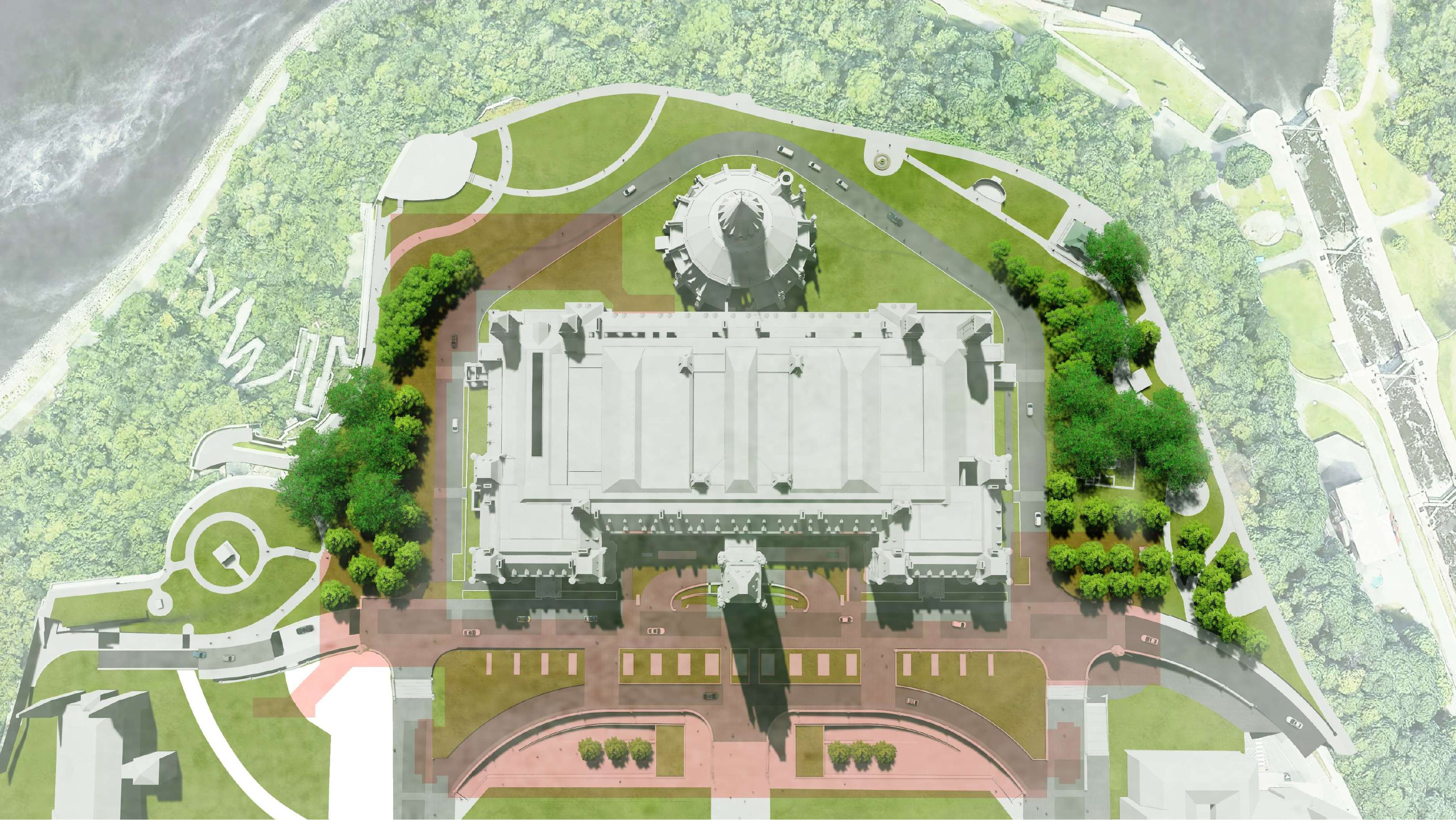
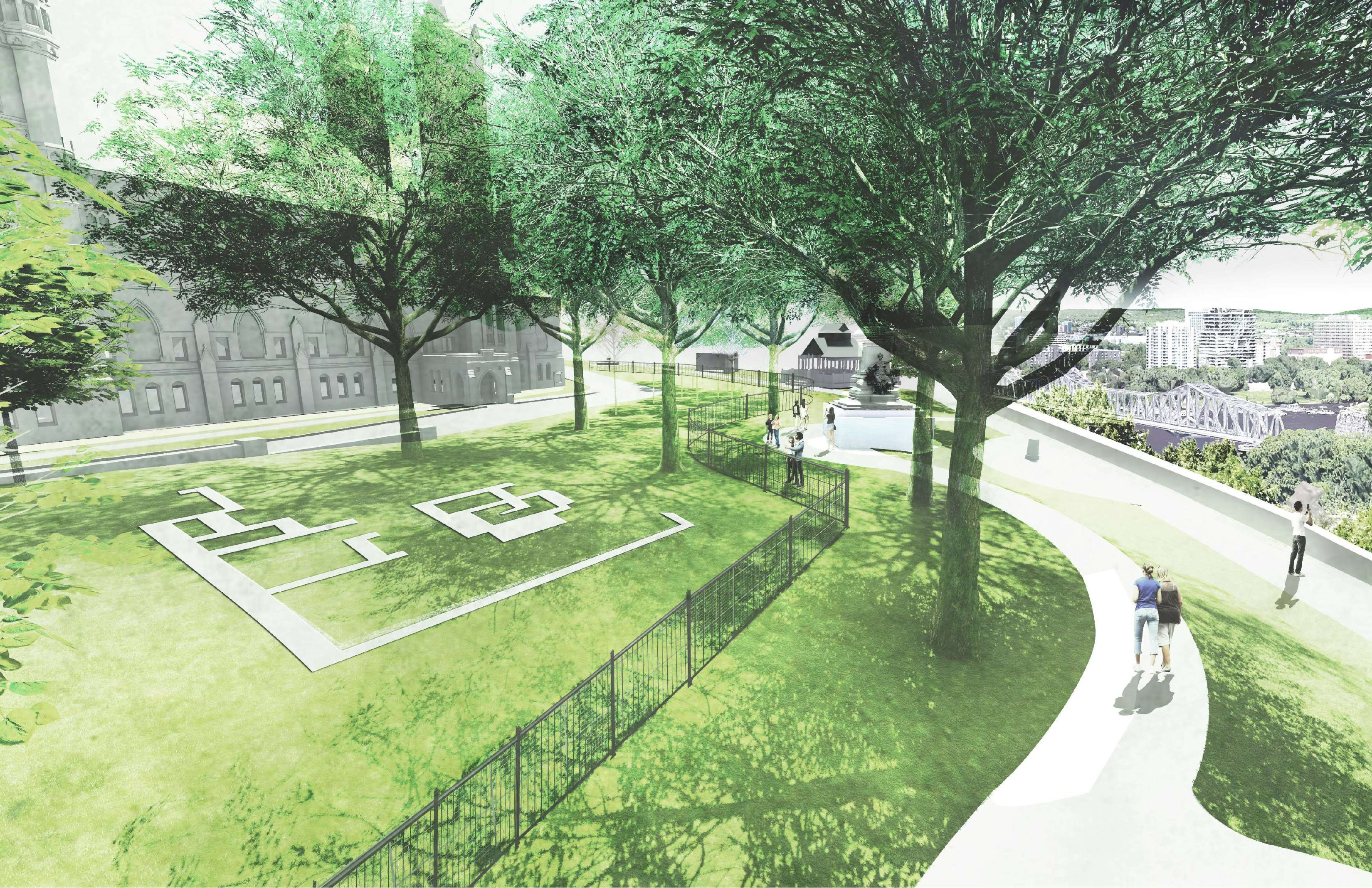
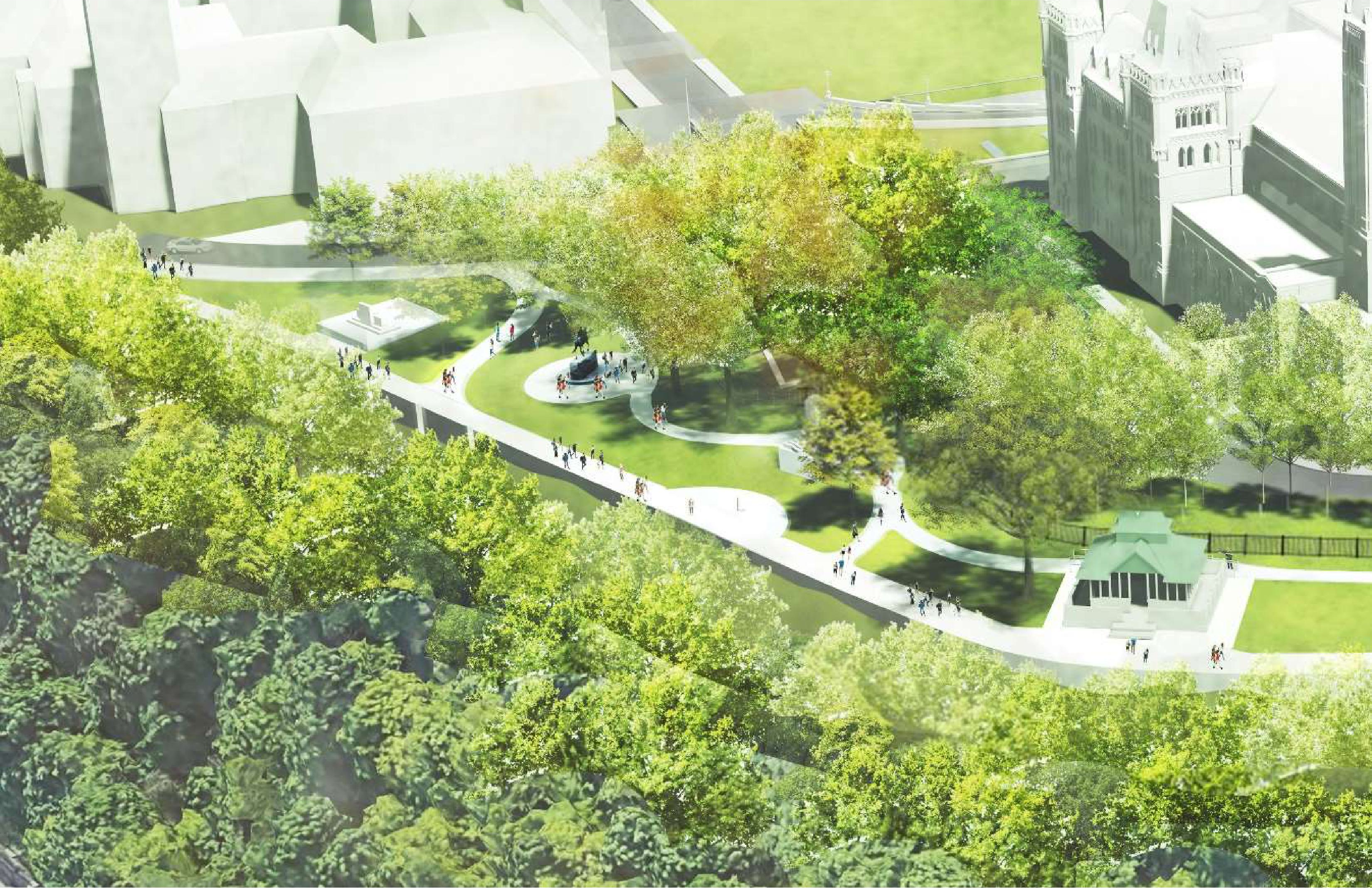
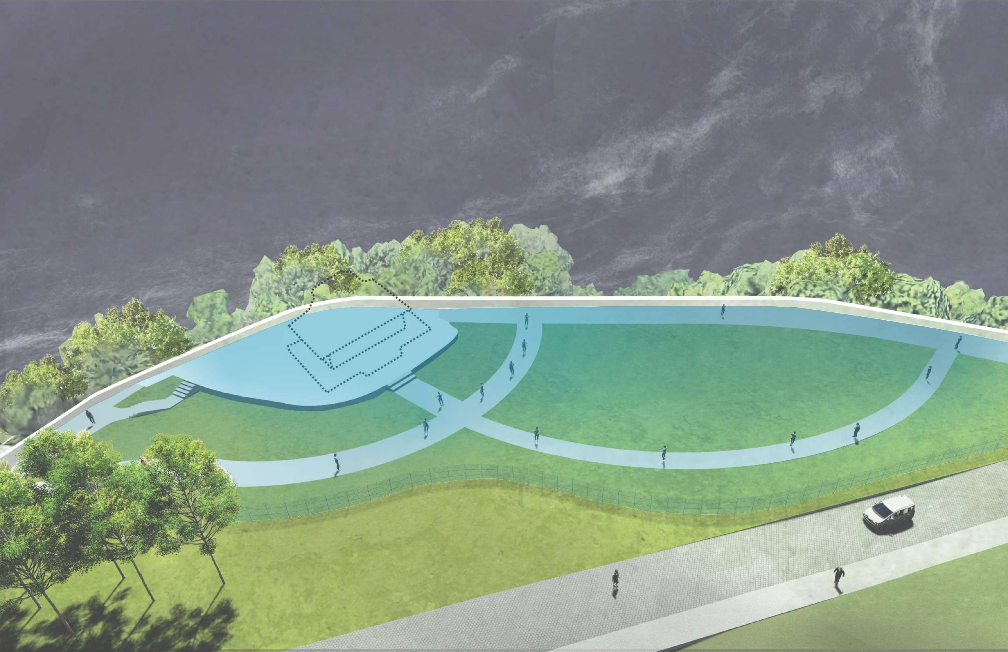
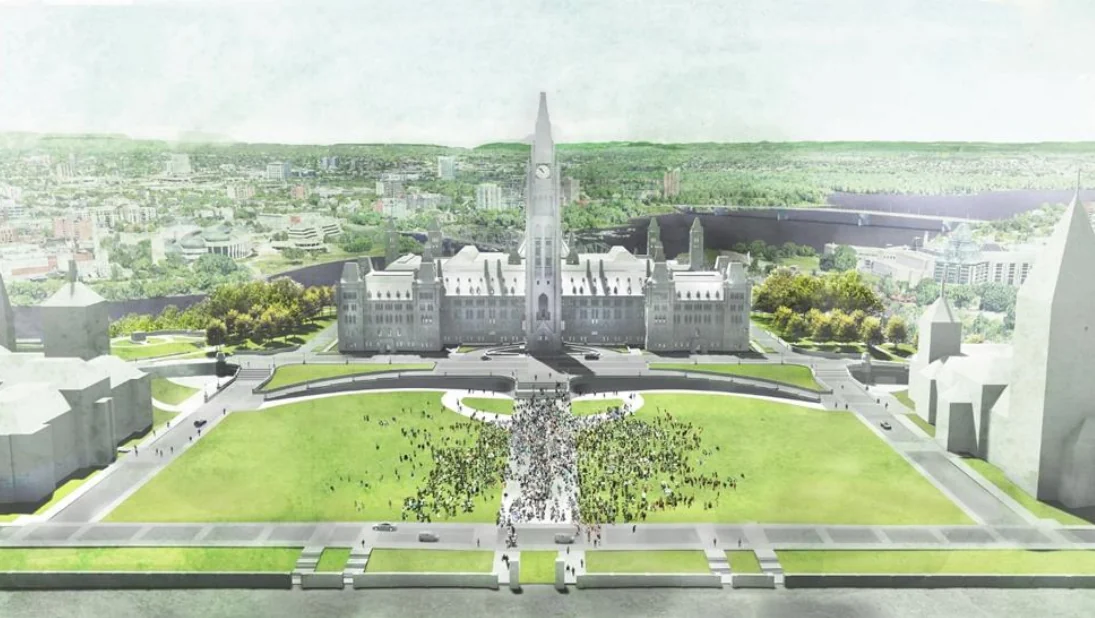
The Centre Block rehabilitation includes new parliamentary infrastructure, an underground Parliament Welcome Centre, and renewed grounds on Parliament Hill. The HOK–WSP CENTRUS partnership leads the wider project. The landscape work has to conserve the heritage setting and keep the lawns and grounds accessible for gathering, celebration, and remembrance.

Location
Ottawa, Ontario
Role
Project Designer · BIM Specialist / BIM Manager
Project period
2019–2021
Project status

OngoingMy contribution: BIM coordination and landscape modelling in Revit.

Centrus Parliamentary Precinct landscape masterplan rendering
MoreLess
My role and contribution

As Project Designer, I worked on landscape concept design for Centre Block and the Parliament Welcome Centre. I prepared site studies, proposals, and visualizations within HOK’s team, working through how public spaces and walking routes meet the buildings and Parliament Hill’s heritage landscape.

BIM coordination and design development

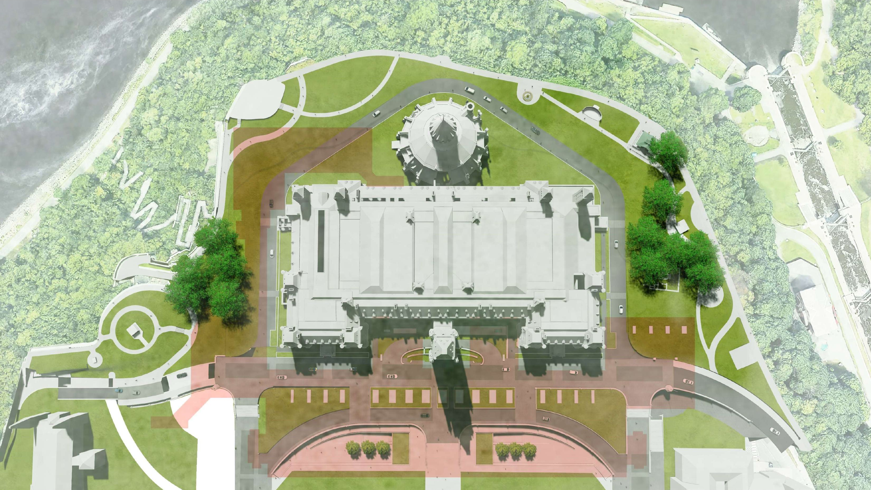
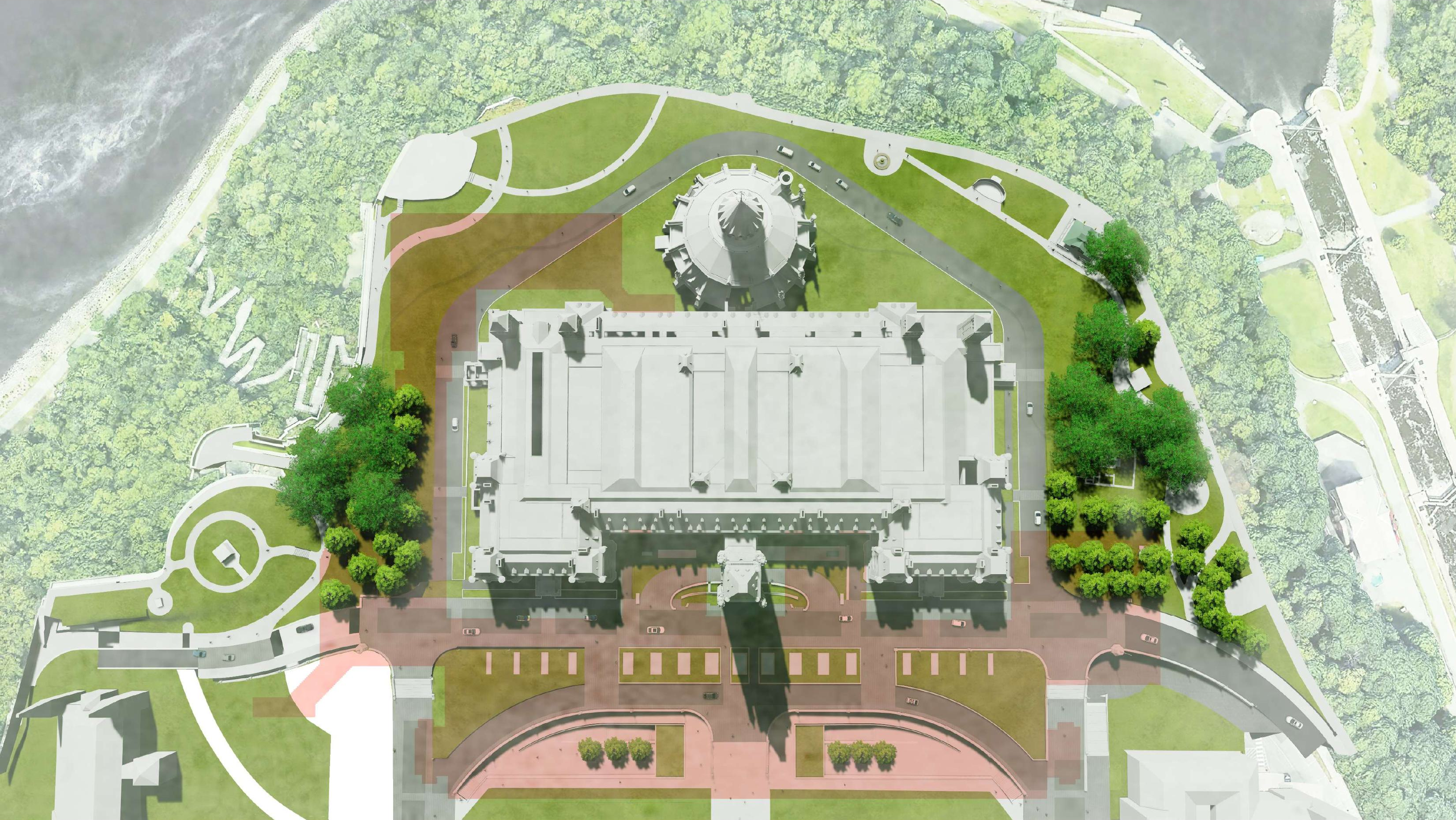
As BIM Specialist / BIM Manager for my scope, I built and maintained the landscape Revit models and coordinated them with the wider consultant team. The models recorded site levels, walking routes, and connections around Centre Block and the Welcome Centre as the concepts developed.

Public project information

HOK’s project page describes the modernization of Centre Block, the Peace Tower, and adjacent grounds, including the underground Welcome Centre, alongside heritage conservation. Canadian Architect also covers accessibility, conservation, and infrastructure renewal. These sources describe the overall project; my role above covers my own contribution.

Portfolio notice. Project background comes from the linked public sources. Materials illustrate my contribution, without implying sole authorship. They are not official or complete project documents. Rights remain with HOK, WSP / CENTRUS, the Government of Canada, credited consultants, and their respective rights holders. Source credits apply. Models and renderings show concept studies, not completed construction. Original drawing labels apply. Display here does not grant reuse permission. Contact the project owner or rights holder for approved documents, current information, or reuse permissions.

International

3 projects
05 · Cairo · Arcadis

Mall of Egypt Business Park — JUNCTION

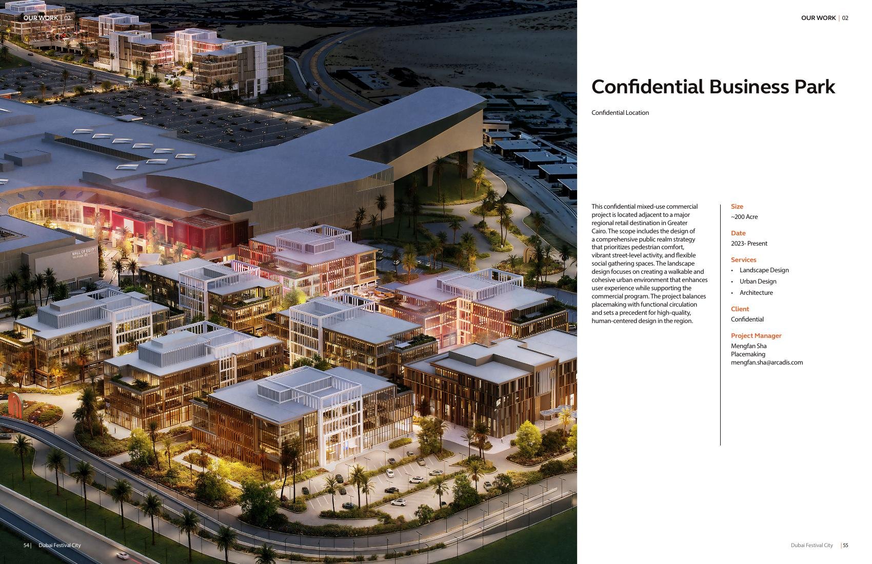
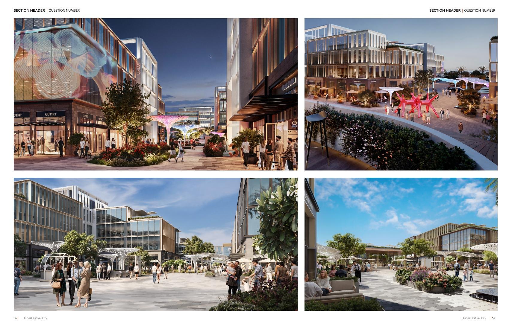
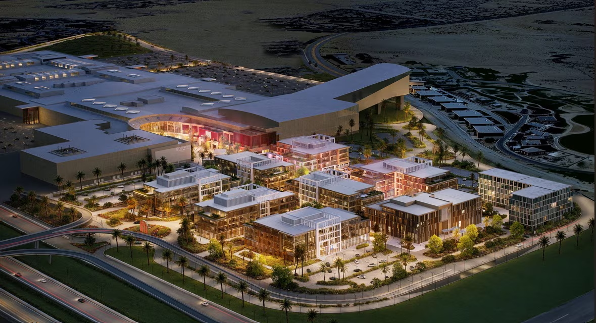
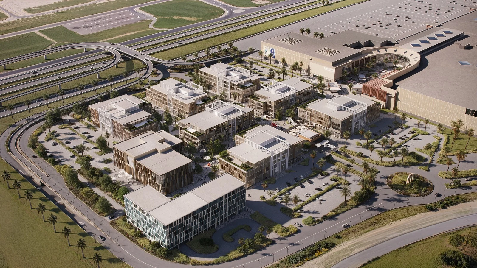
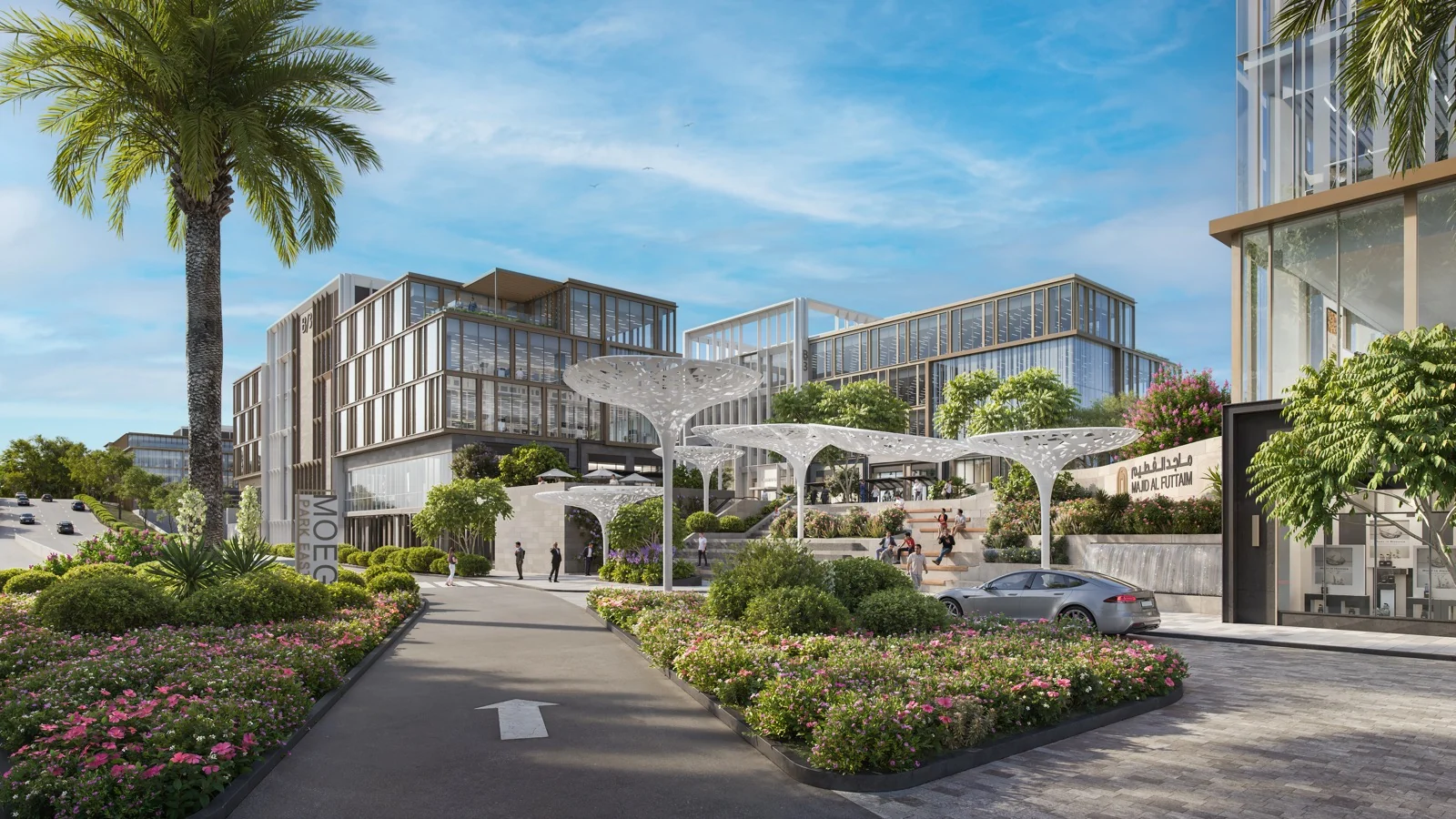
JUNCTION is an office and mixed-use development by Majid Al Futtaim beside Mall of Egypt in West Cairo. Its approximately 99,000 square metres of built-up area include eight office buildings, shops, dining, and a planned hotel. Landscaped promenades and open-air plazas connect the buildings, with a direct walking link to the mall. The development targets LEED Gold certification.

Location
6th of October City, Giza, Egypt
Role
Landscape Project Designer · Project Lead · Project Manager
Period
2024–2025
Project status

Pre-sales / marketing phaseMy contribution: Landscape design and project coordination for arrival areas, promenades, and shared public spaces.

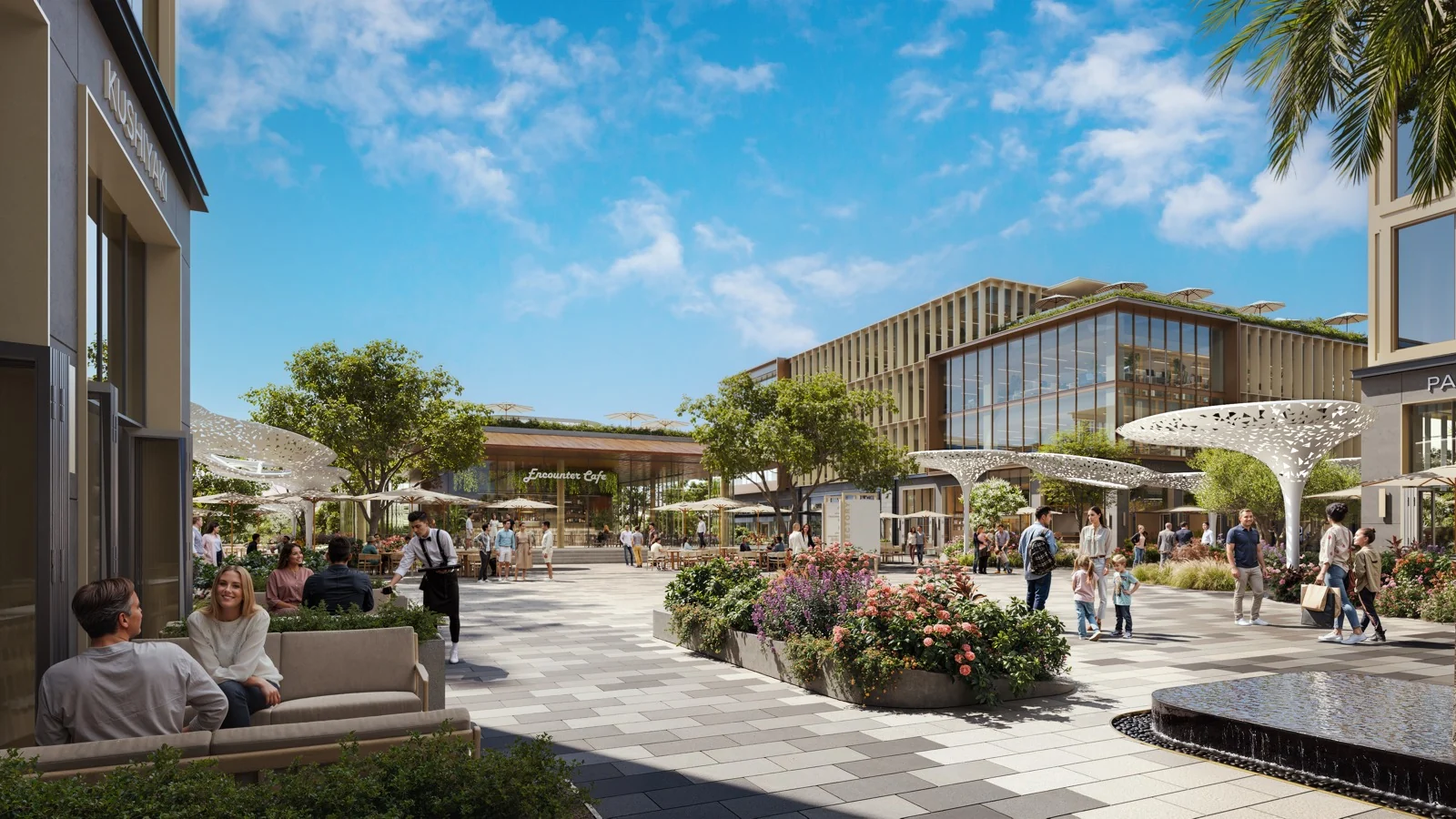
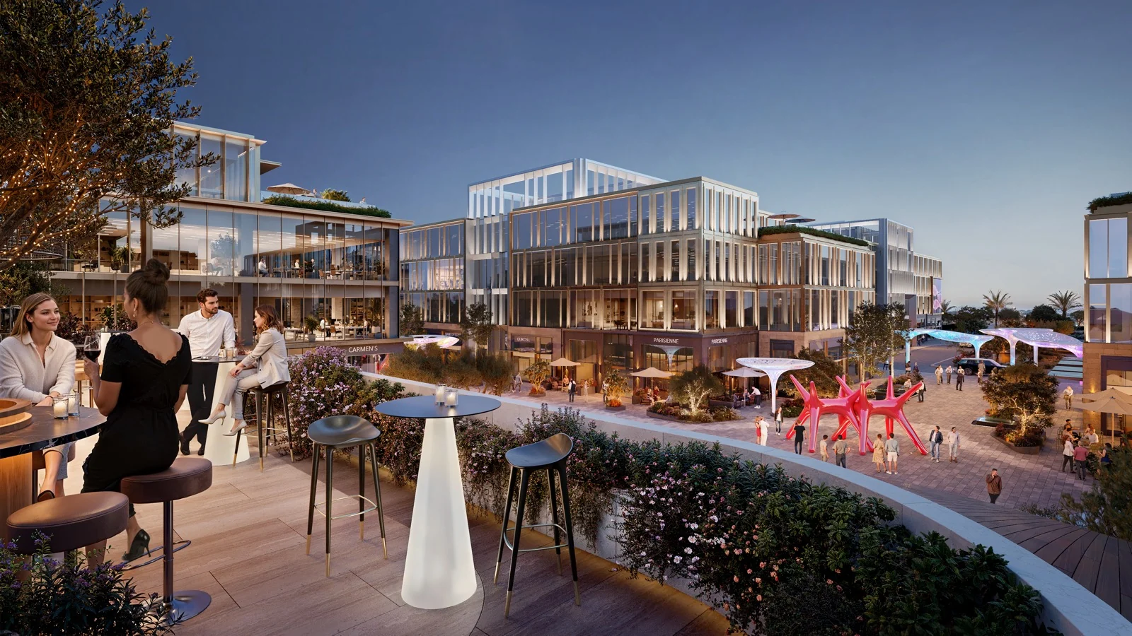
Night-time aerial rendering of JUNCTION office buildings and landscaped public spaces beside Mall of Egypt
JUNCTION beside Mall of Egypt, with offices, landscaped public spaces, and walking connections. Visualization from the supplied MOEG image set.
MoreLess
My role and contribution

As Landscape Project Designer and Project Manager, I led the landscape and public-space design across the campus. My scope included arrival areas, shaded walking routes, gathering spaces, planting, and paving, with a consistent design across the site.

I worked with the client, architects, engineers, and specialist consultants to resolve design requirements within the scope and schedule, including quality and sustainability goals. The landscape links building entrances and drop-offs with shared outdoor spaces, with attention to shade, comfort, and everyday use.

Public project information

The overview draws on JUNCTION’s website and Majid Al Futtaim’s public announcement dated 1 June 2026. The announcement reports the start of enabling works and identifies LEED Gold as a certification target.

Portfolio notice. Project background comes from the linked public sources. Materials illustrate my contribution, without implying sole authorship. They are not official or complete project documents. Rights remain with Arcadis, Majid Al Futtaim, and the relevant project parties. Source credits apply. Display here does not grant reuse permission. Contact the project owner or rights holder for approved documents, current information, or reuse permissions.

06 · Dubai · Arcadis

Ghaf Woods — Phases 3 & 4

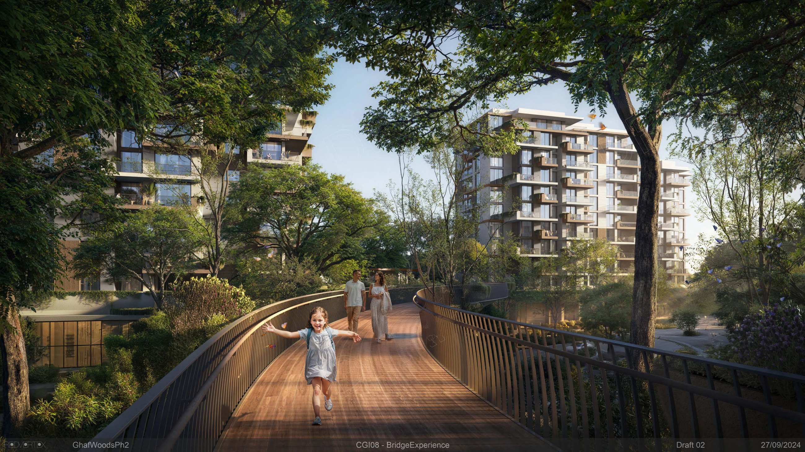
Ghaf Woods is a residential and mixed-use community in Dubai organized around a forest-living concept. Planting and walking routes connect homes, gathering spaces, and outdoor amenities at ground and podium levels. The design responds to Dubai’s climate, with attention to comfort, everyday use, and the resilience of the planting and landscape.

Location
Dubai, United Arab Emirates
Role
Landscape Project Designer · Project Lead · Project Manager
Scope
Phases 3 & 4 · Podium and ground-level landscape
Project status

Pre-sales / marketing phaseMy contribution: Landscape design and project coordination for Phases 3 & 4, including podium and ground-level spaces.

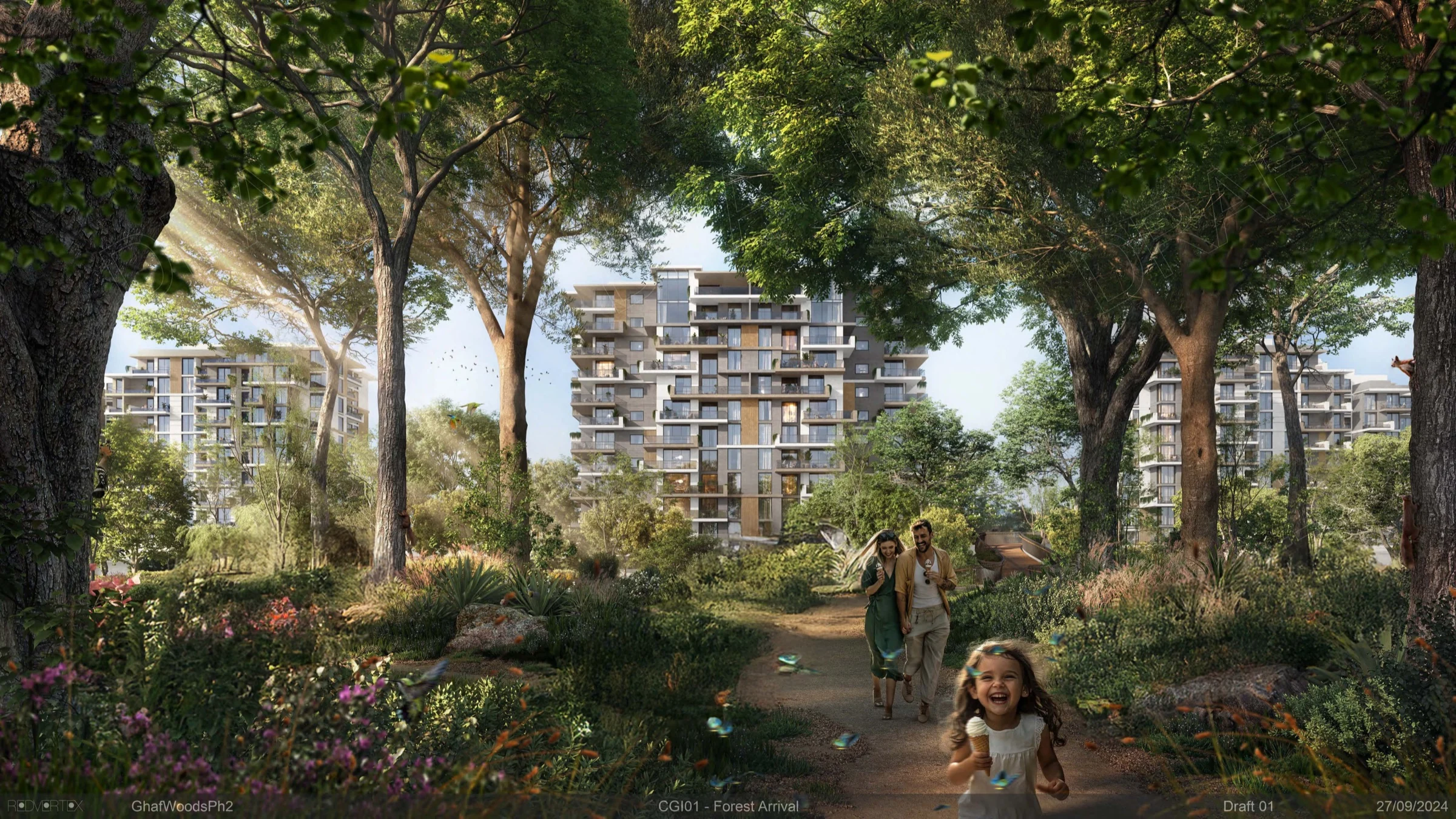
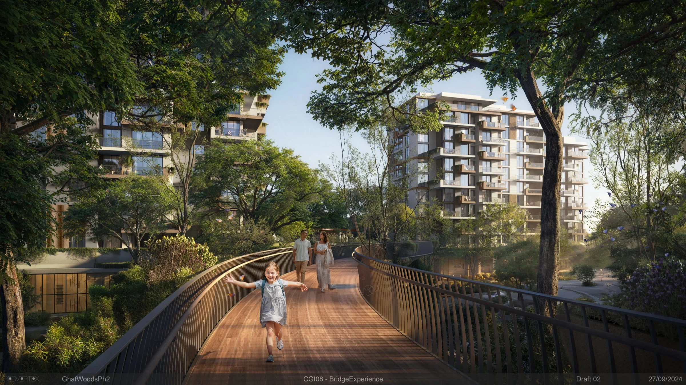
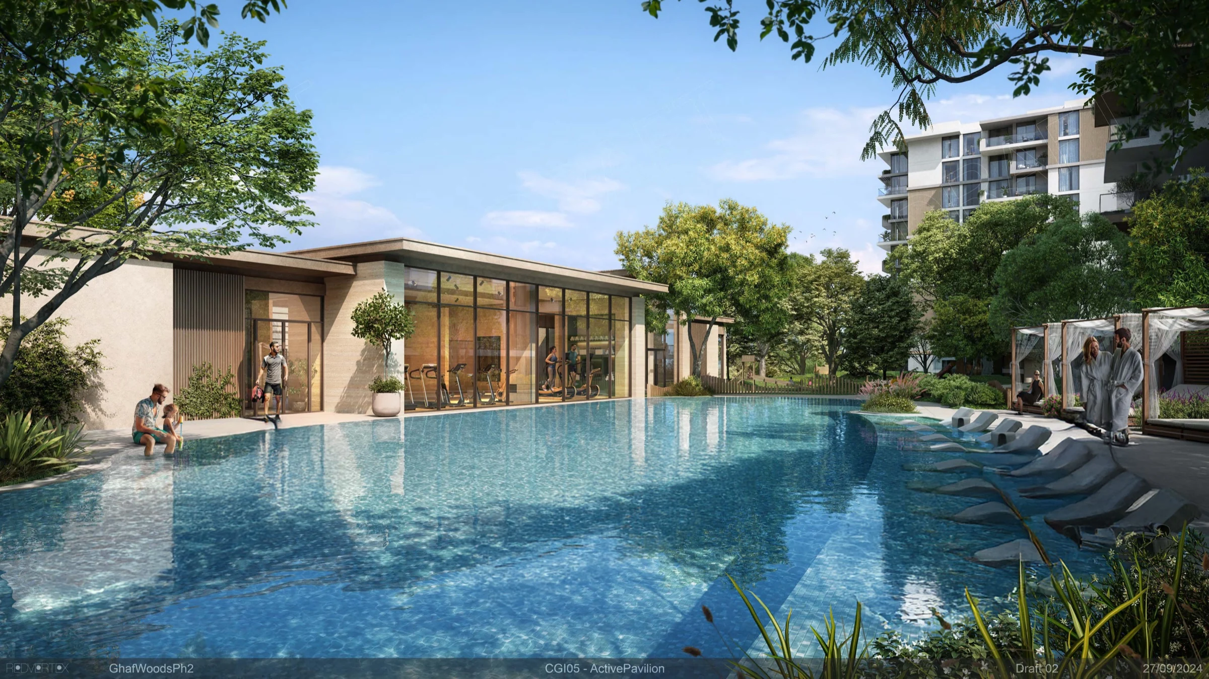
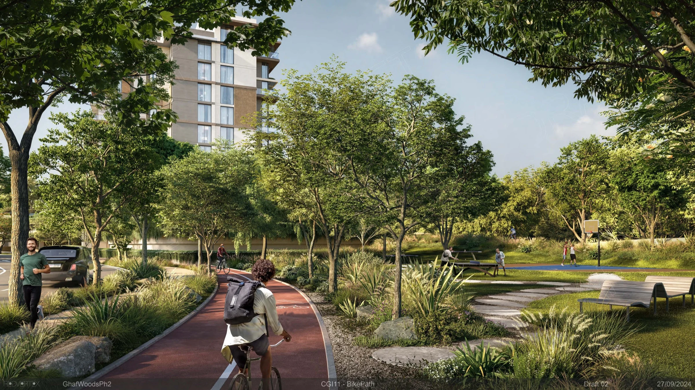
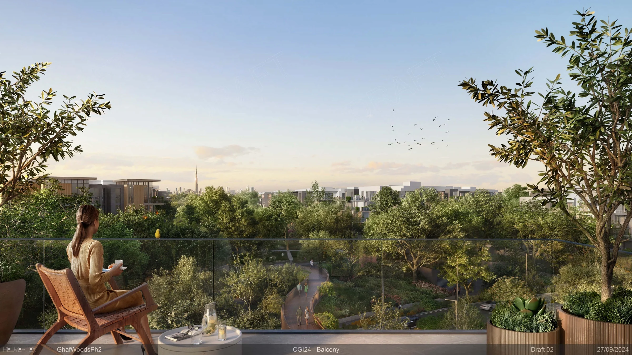
Ghaf Woods forest arrival rendering with planted walking paths and residential buildings framed by mature trees
Forest Arrival — community design context. Supplied visualization labelled GhafWoodsPh2; Image credit: supplied Ghaf Woods visualization team.
MoreLess
My role and contribution

I was Landscape Project Designer and Project Manager for Phases 3 & 4, covering podium and ground-level landscapes. I led the design work and coordinated the client, architects, engineers, and specialist consultants to develop the forest-living concept across those spaces.

Responsibilities and delivery

I coordinated landscape work and consultant inputs against the scope, schedule, budget, and deliverables. The work addressed Dubai’s climate, resident comfort, and landscape resilience where the site meets the buildings. LEED Gold and WELL were project objectives, not confirmed certifications.

Public project information

Ghaf Woods’ official Distrikt page describes a forest-inspired community with homes, shops, dining, workspaces, and shared amenities. It lists gathering spaces, wellness facilities, rooftop pool lounges, and sky gardens. The page gives wider community context; my role was on Phases 3 & 4, as recorded in my resume.

Portfolio notice. Project background comes from the linked public sources. Materials illustrate my contribution, without implying sole authorship. They are not official or complete project documents. Rights remain with Arcadis, Majid Al Futtaim, the credited visualization team, and the relevant rights holders. Source credits apply. The GhafWoodsPh2 visualizations provide wider community context; my role covers Phases 3 & 4. Annotation strips are cropped for display; source files retain original credits and draft labels. Display here does not grant reuse permission. Contact the project owner or rights holder for approved documents, current information, or reuse permissions.

07 · Los Angeles · Agence Ter

Pershing Square

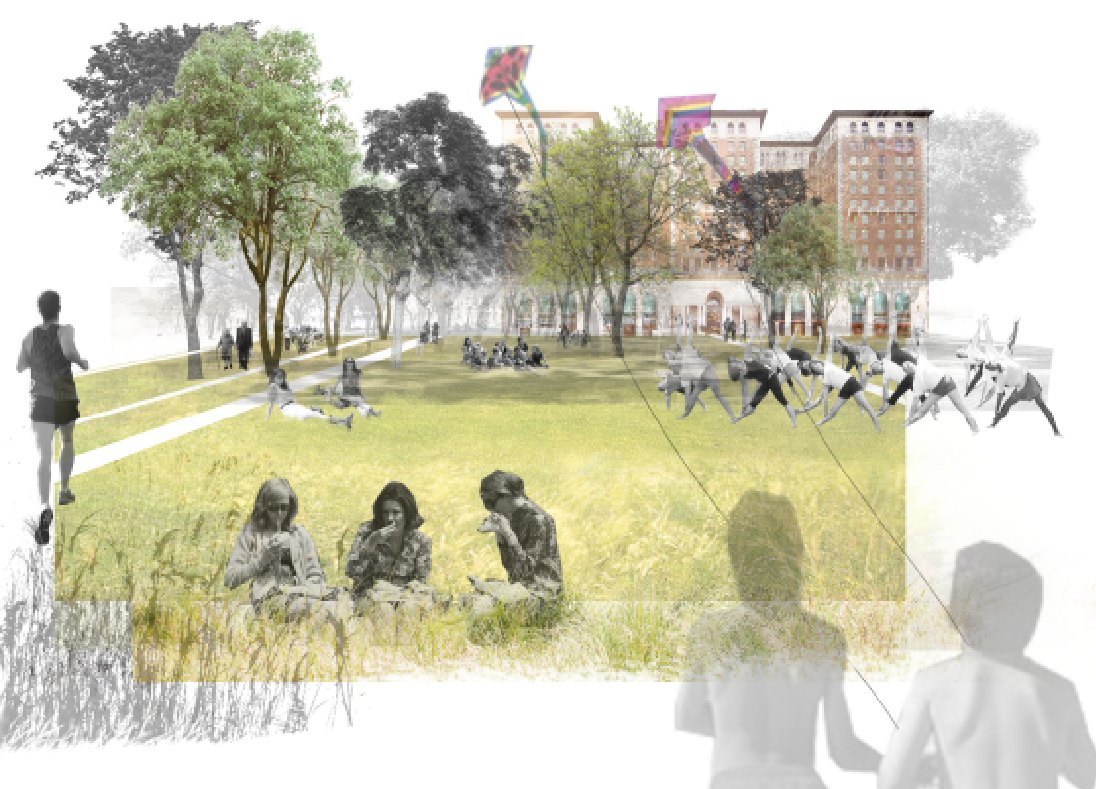
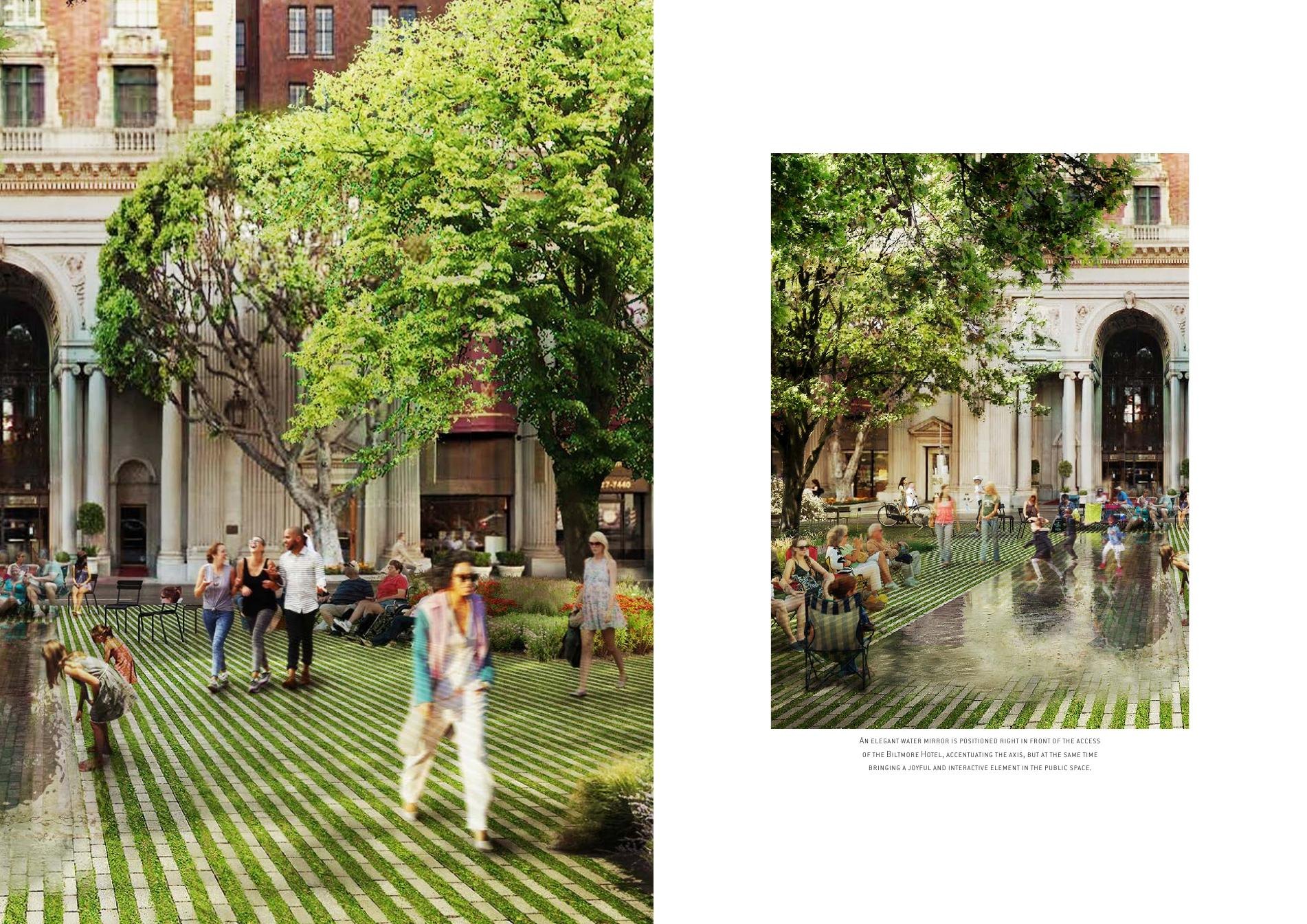
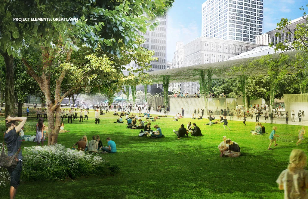
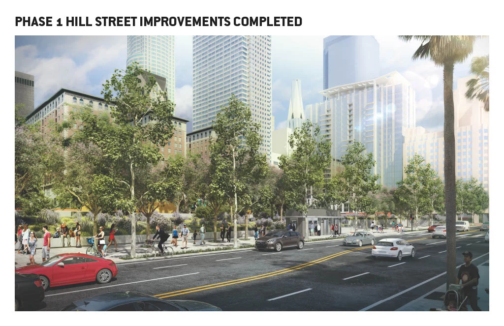
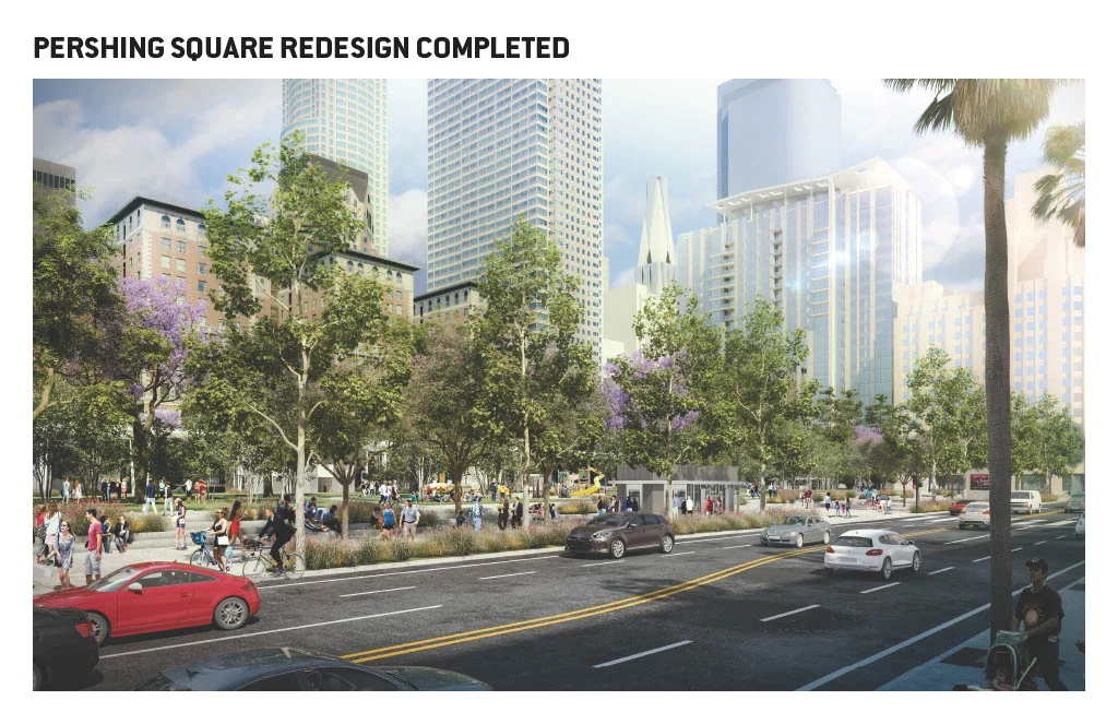
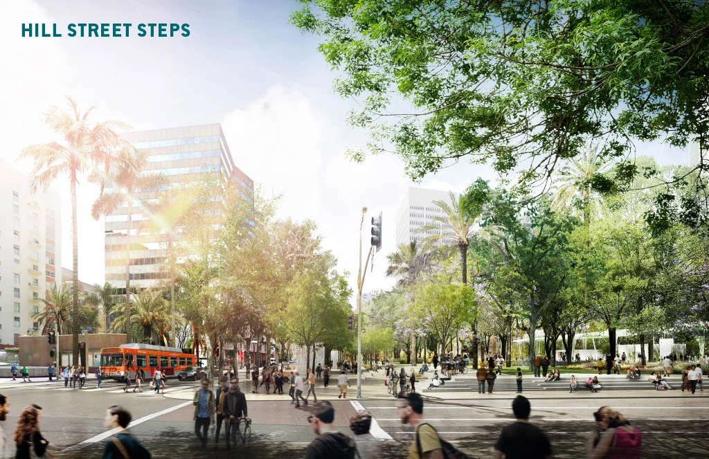
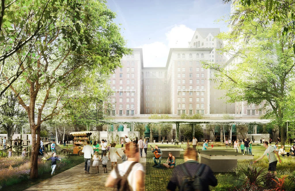
Pershing Square’s phased redesign aims to open the historic downtown Los Angeles square to its surrounding streets. The proposal uses clearer walking connections, planting, gathering spaces, and flexible programming to make the square more accessible. An existing parking structure beneath the site makes changes to levels and access particularly challenging.

Location
Downtown Los Angeles, California
Role
Project Designer
Period
c. 2018–2019
Project status

Phase 1 · Design development (DD)My contribution: Project Designer for Phase 1 concept design and design development.

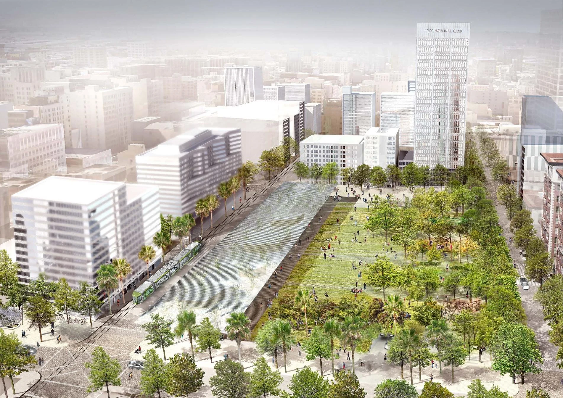
Aerial concept rendering of Pershing Square’s proposed lawn, canopy and surrounding public realm
MoreLess
My role and contribution

As Project Designer, I worked on Phase 1 concept design and design development (DD) with Agence Ter’s French team. We worked across landscape, urban design, and building interfaces to develop a more accessible, adaptable, and sustainable plaza, with planting and public spaces that support walking, transit access, and daily use.

Responsibilities and design challenge

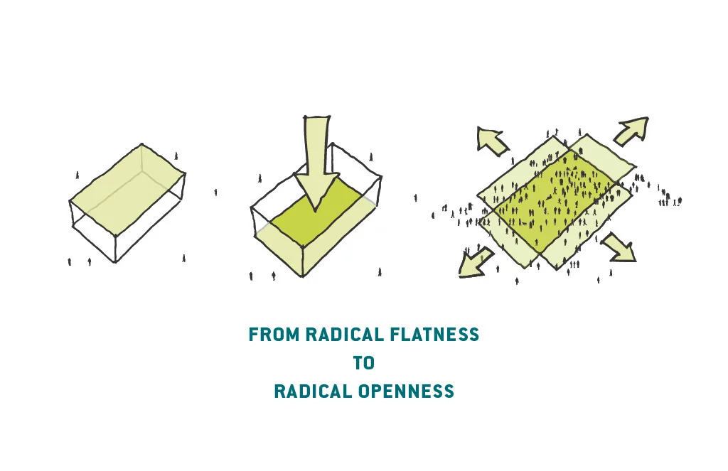
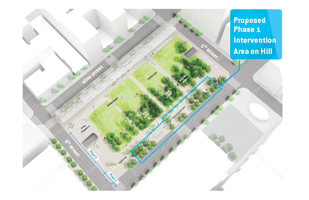
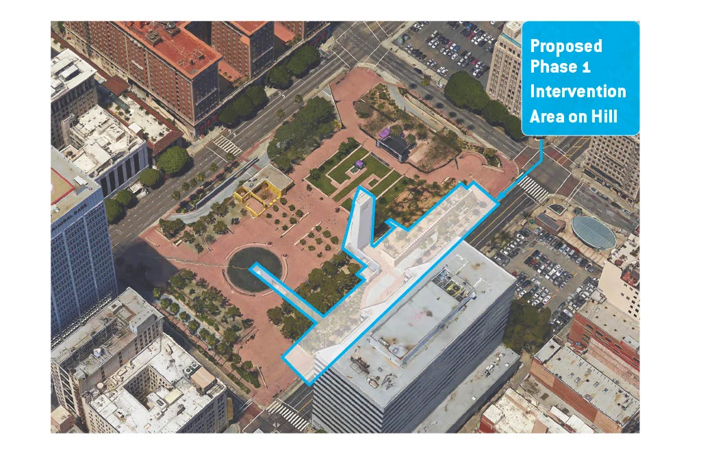
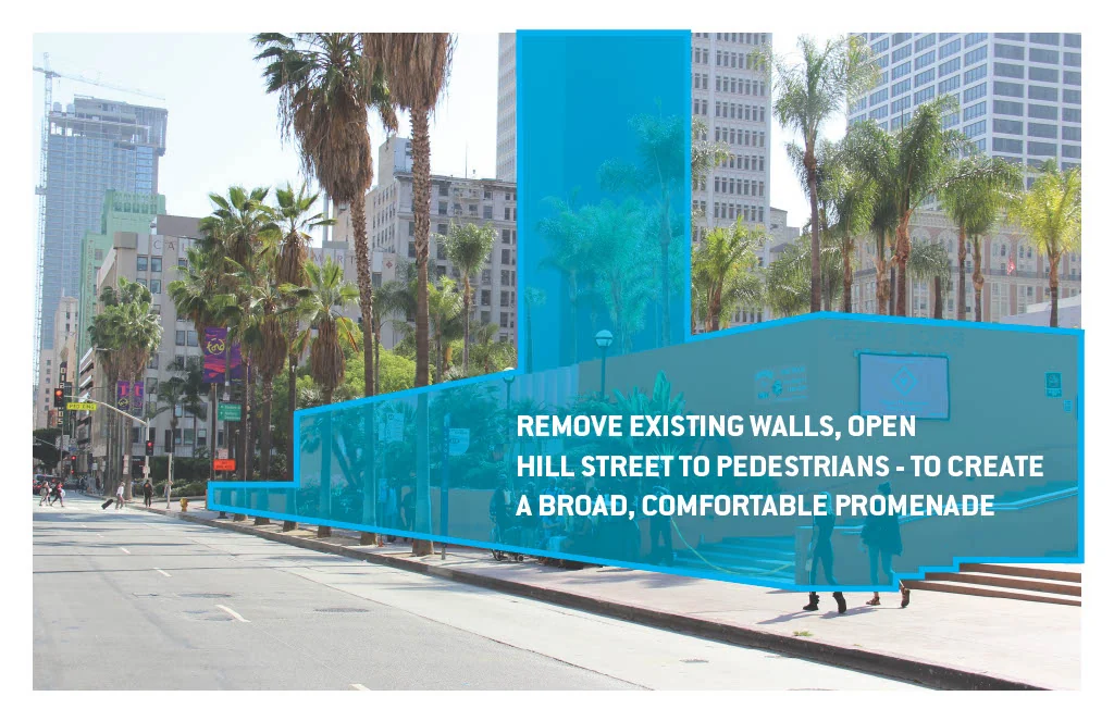
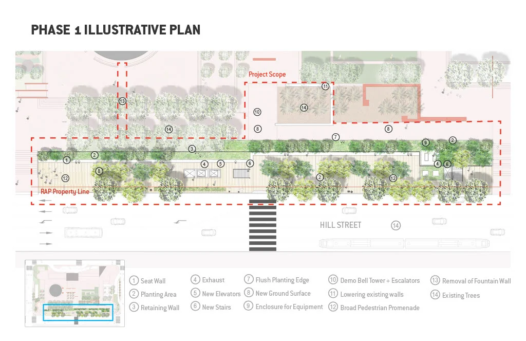
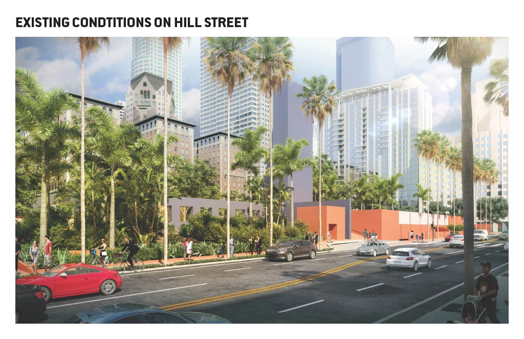
Phase 1 focused on opening the Hill Street edge to improve visibility and access and make room for a wider promenade. It was the first step toward the broader “radical flatness” concept. Removing barriers meant working through street levels, park levels, and access above the existing parking structure. The structural deck and the garage below set important limits on what could change.

Public project information

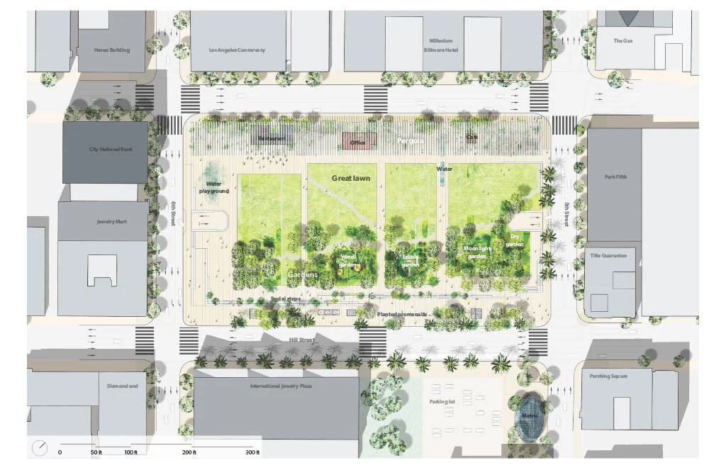
Agence Ter’s broader proposal includes an open lawn, shaded gardens, and a canopy for different activities. Gruen Associates describes the phased approach, starting at Hill Street. Full “radical flatness” is part of the longer-term redesign. The images below include both Phase 1 studies and the broader concept.

Portfolio notice. Project background comes from the linked public sources. Materials illustrate my contribution, without implying sole authorship. They are not official or complete project documents. Rights remain with Agence Ter, credited consultants, the project owner, and their respective rights holders. Source credits apply. Concept and phased-design renderings do not show completed construction, including images originally labelled “completed.” Original drawing labels apply. Display here does not grant reuse permission. Contact the project owner or rights holder for approved documents, current information, or reuse permissions.

Innovation

1 project
08 · Arcadis · Research & innovation

Dynamic Carbon Model

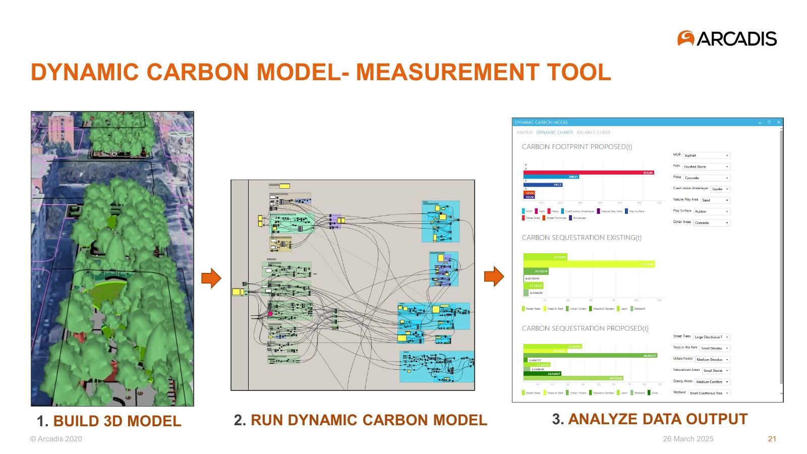
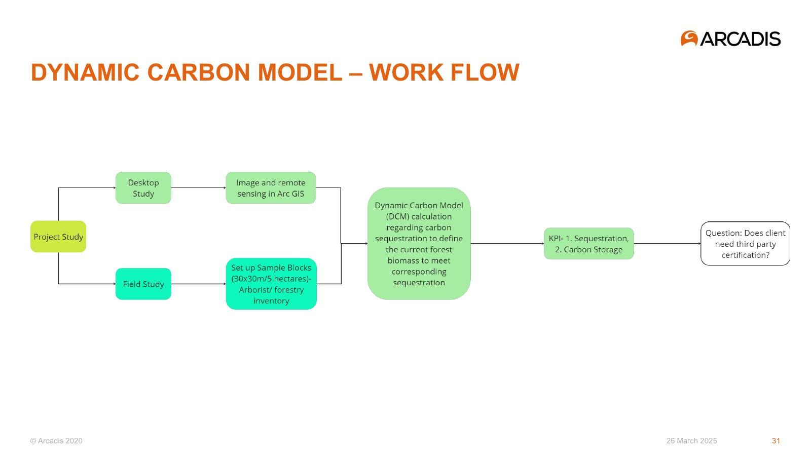
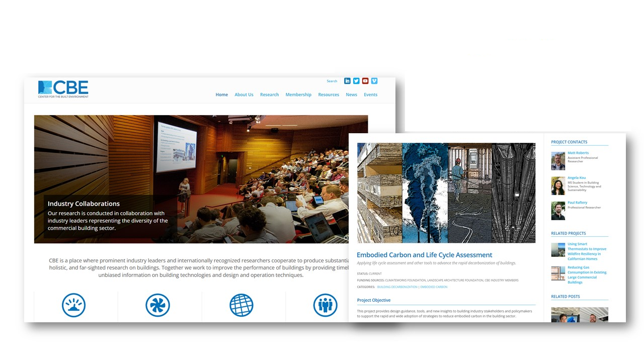
The Dynamic Carbon Model (DCM), developed within Arcadis, helps landscape designers compare the carbon effects of design choices. It estimates emissions from construction materials alongside carbon sequestration by vegetation and soils.

Location
Toronto, Ontario · Research platform
Role
Co-developer · Sustainability Specialist · Project Designer & Coordinator
Period
c. 2024–Present
Project status

Research and developmentMy contribution: Scripting and Python integration support, data preparation, workflow development, service scoping, fee proposals, and pilot studies.

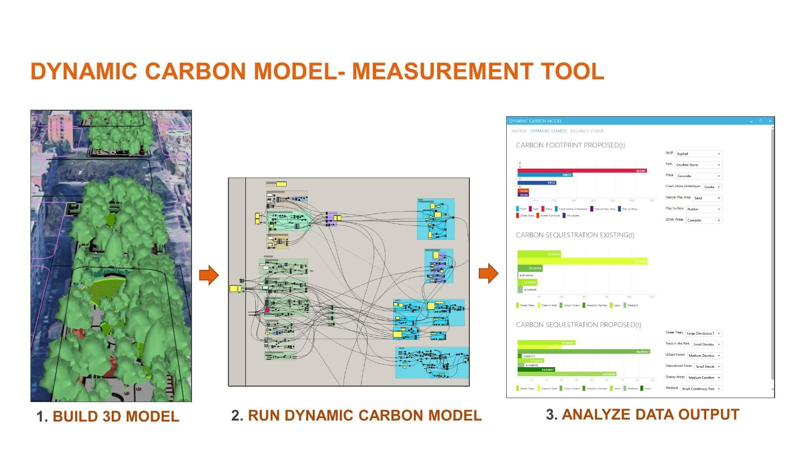
Dynamic Carbon Model interface with carbon charts and the David Crombie Park landscape model
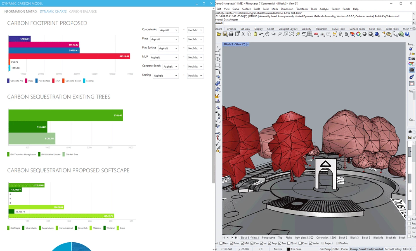
A Dynamic Carbon Model demonstration using David Crombie Park. The landscape model supplies inputs for the carbon analysis.
MoreLess
What the model does

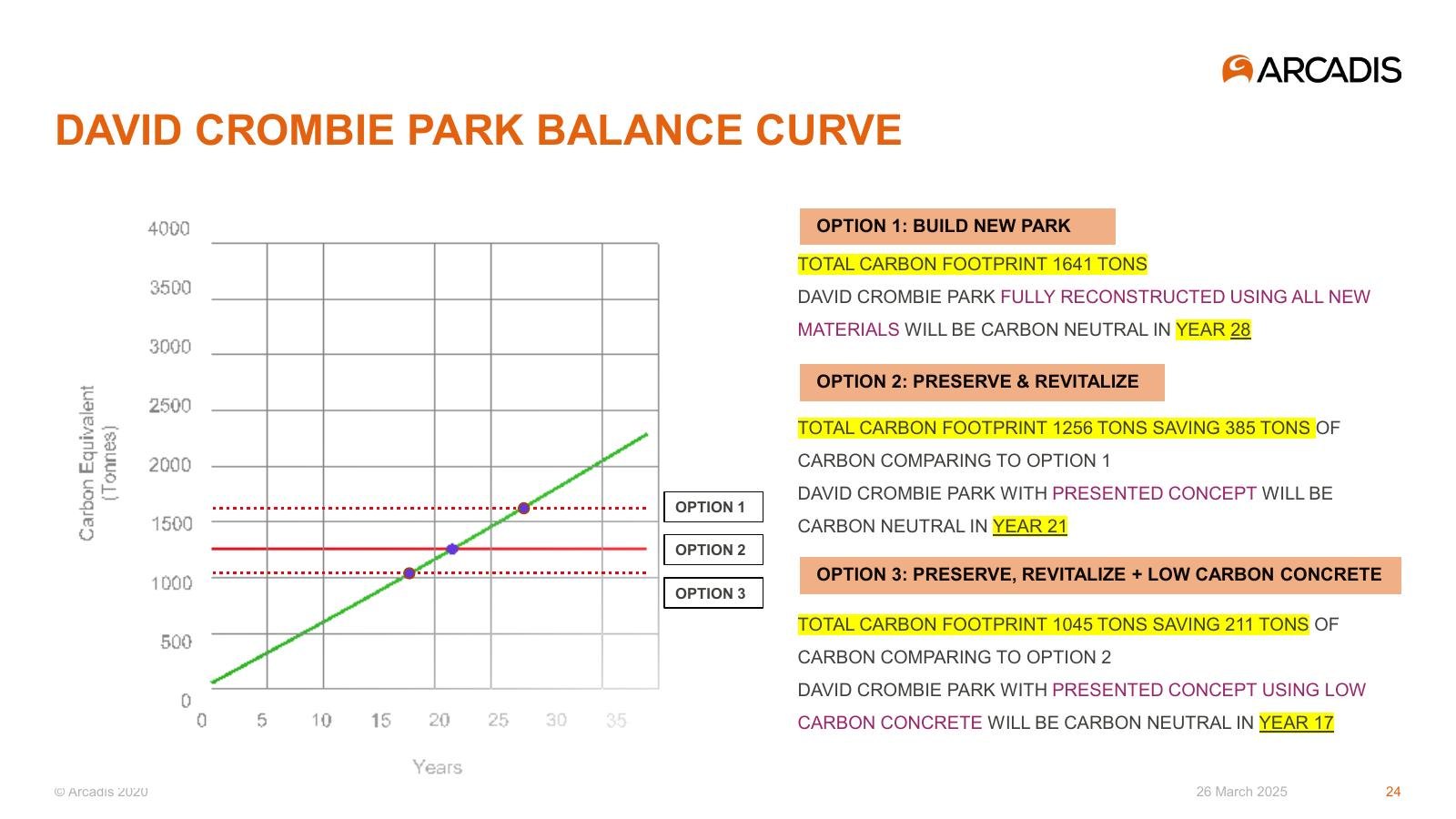
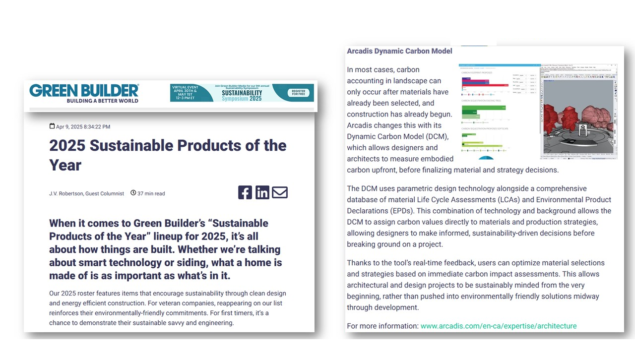
The DCM uses Grasshopper and Python with material life-cycle assessment data, Environmental Product Declarations (EPDs), and estimates of vegetation and soil carbon. As quantities and specifications change, designers can compare construction emissions with projected sequestration over time. This helps them assess the effects of retaining features, reusing materials, choosing lower-carbon products, and retaining or adding planting and soil carbon storage.

My role and contribution

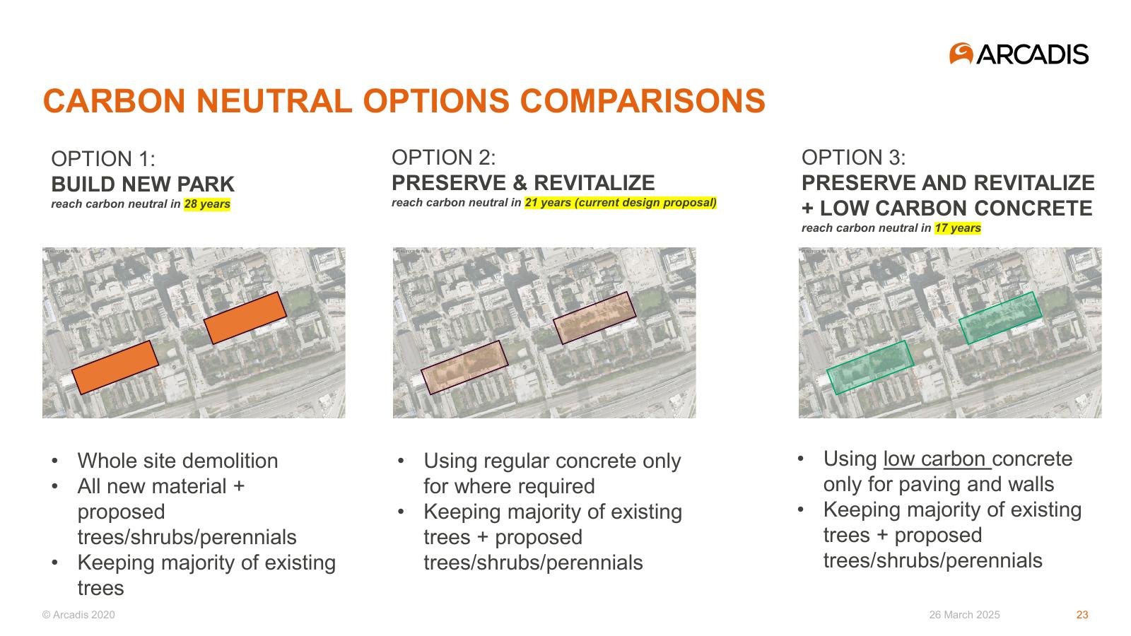
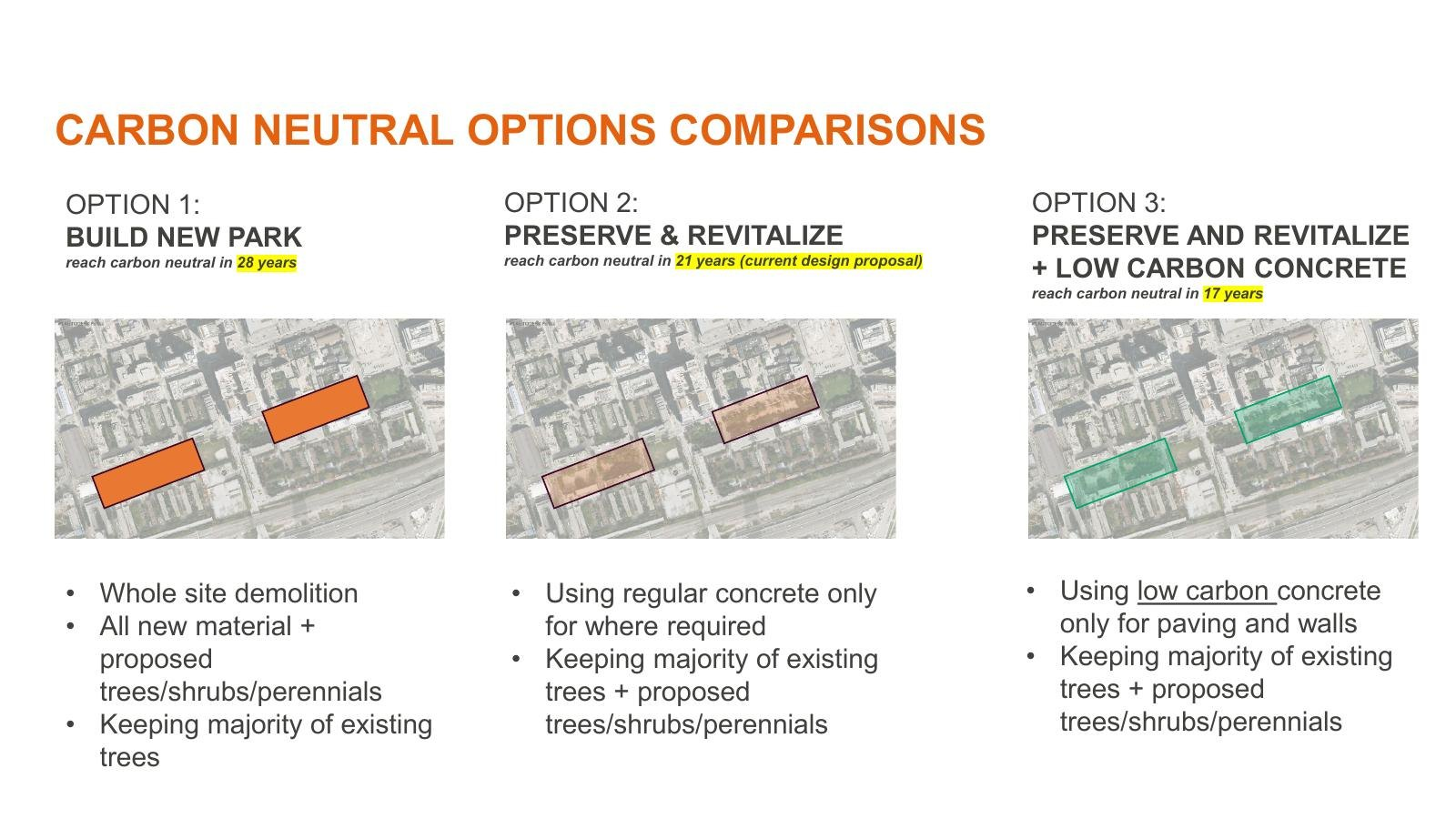
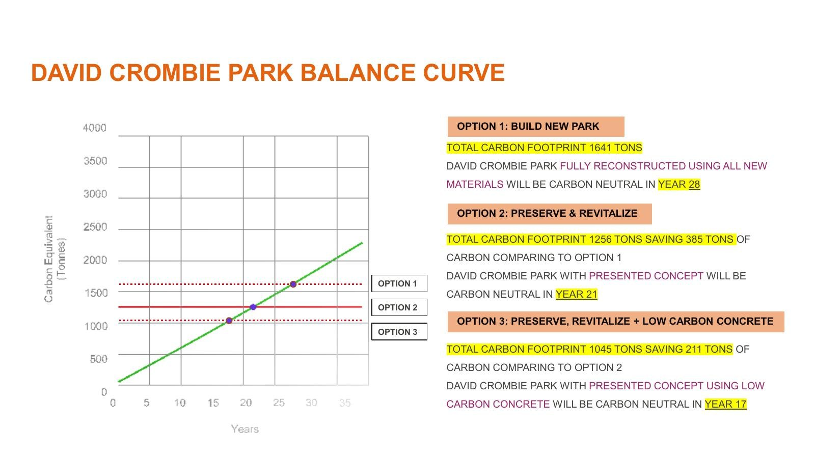
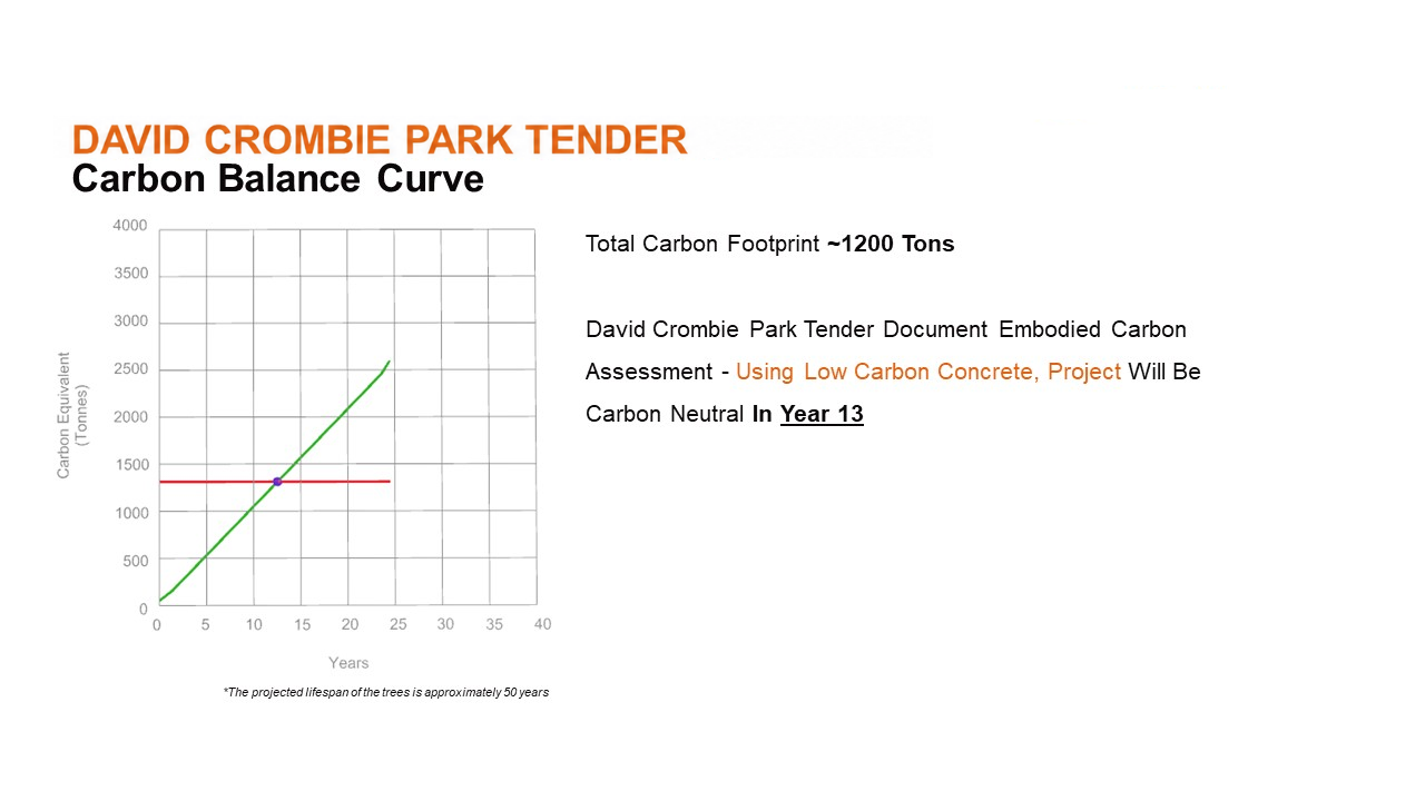
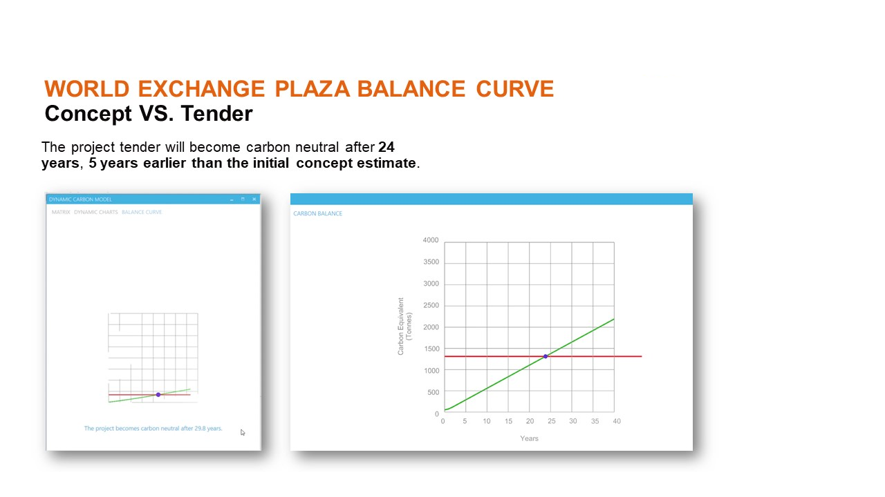
I contributed to the model’s scripts, organized input data, and supported Python integration. I explained the underlying calculation logic and how the inputs relate to the results. On David Crombie Park, I assessed carbon balance and payback periods and compared design options to inform material and construction decisions.

Workflow and service scope

I led development of the modelling workflow and coordinated developers, ecologists, and ESG specialists through workshops and reviews. I scoped modelling services and prepared fee proposals. I also helped incorporate biodiversity into the model alongside carbon analysis.

I helped build support for the tool within City of Toronto teams and bring it into project use. The modelling work now generates fee revenue. Applications include the Hudson Sample Block Carbon Study and Kingston Road Median Greening, with further proposals in development.

Public project information

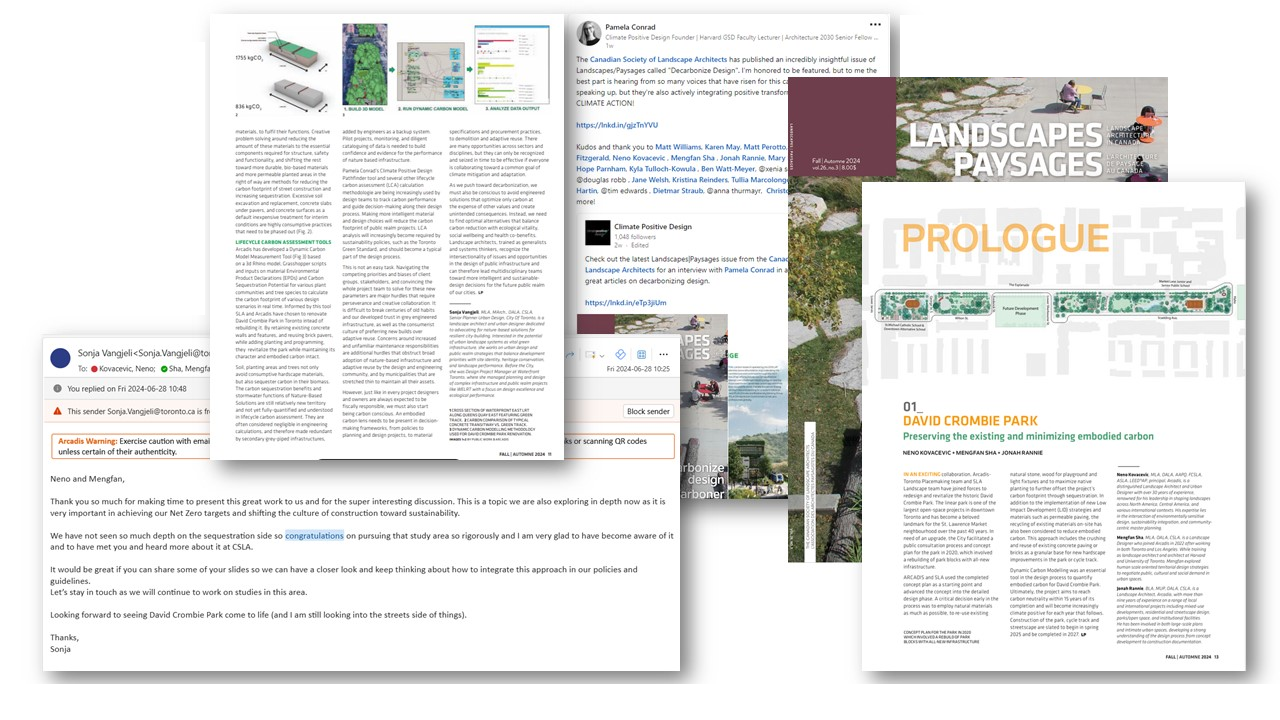
Published articles describe how DCM studies informed decisions to retain and repair park features, reuse paving, and add planting at David Crombie Park. The balance curves and payback periods show projected results based on the project’s inputs and assumptions. They let the team compare the carbon effects of choices while the design is still developing.

Portfolio notice. Project background comes from the linked public sources. Materials illustrate my contribution, without implying sole authorship. They are not official or complete project documents. Rights remain with Arcadis and the relevant project parties. Source credits apply. Carbon results are modelled estimates, not verified outcomes, and depend on inputs, scope, and assumptions. Refer to the linked publications for the research. Display here does not grant reuse permission. Contact the project owner or rights holder for approved documents, current information, or reuse permissions.

Proposals

1 project
09 · Los Angeles · Agence Ter

Silver Lake Reservoir Complex Master Plan

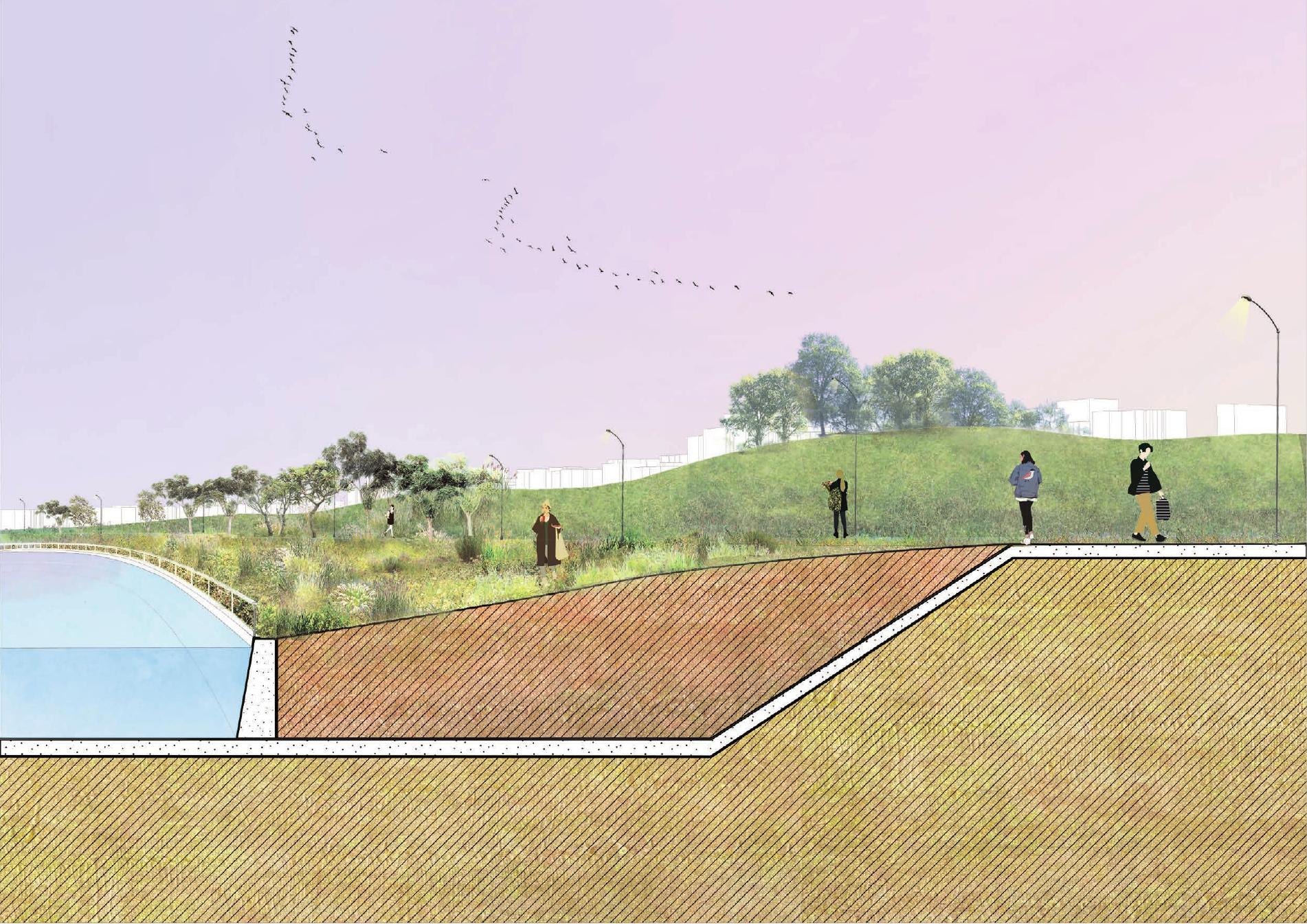
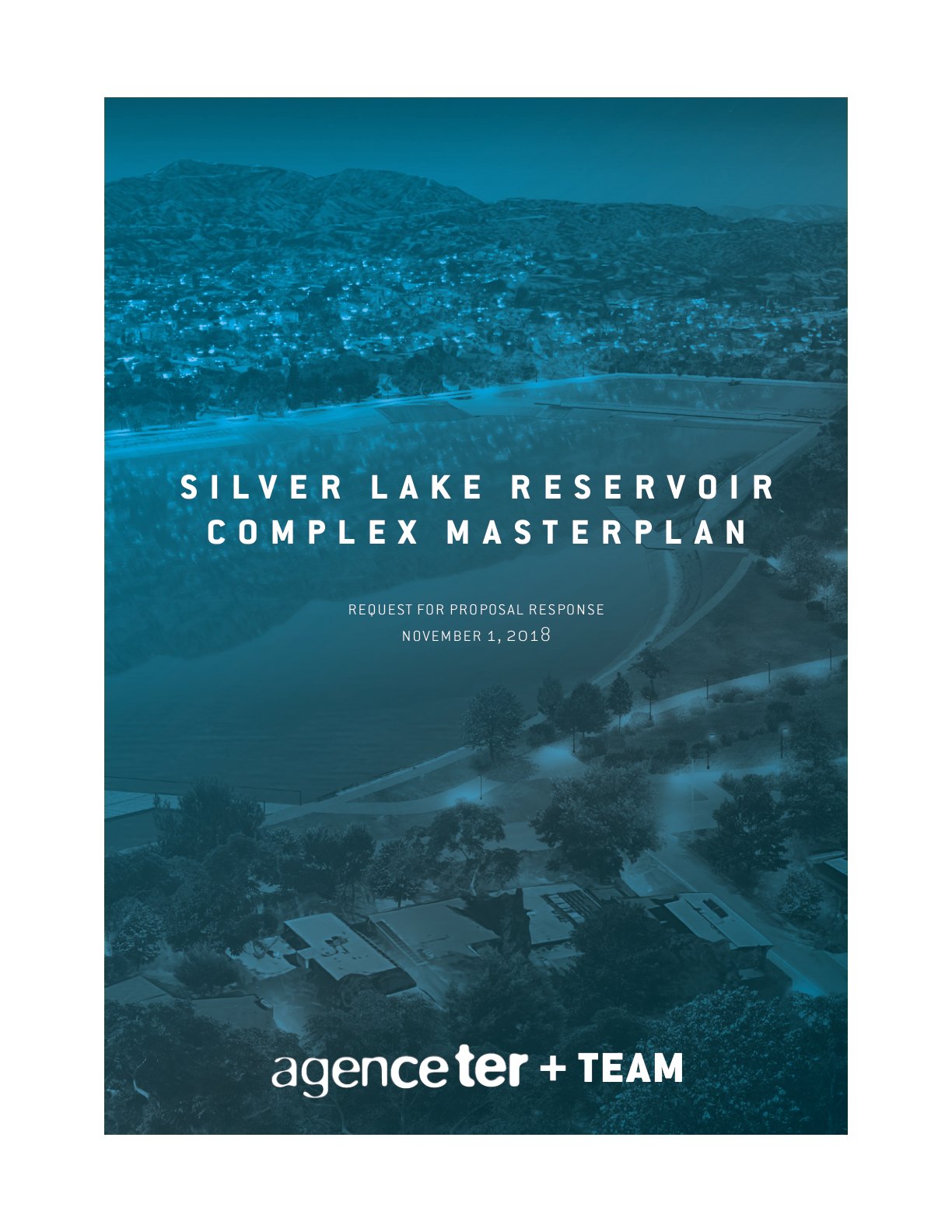
Agence Ter + team was shortlisted for the Silver Lake Reservoir Complex Master Plan in Los Angeles. The proposal uses ecological research, community engagement, and landscape design to explore habitat, recreation, public access, and the reservoir’s heritage. The reader below contains selected pages from the team’s November 2018 proposal.

Location
Silver Lake, Los Angeles, California
Role
Landscape Designer · Shortlisted Proposal Team
Period
c. 2018–2019
Project status

Shortlisted proposal · Not commissionedMy contribution: Concept studies, diagrams, proposal material, and community outreach.

Silver Lake Reservoir proposal, page 1
Cover
MoreLess
My role and contribution

As a Landscape Designer on the shortlisted team, I prepared concept studies, diagrams, and presentation material on habitat, recreation, public access, and heritage. I also helped with community outreach and public engagement, contributing design ideas to a proposed process of research and discussion.

Proposal approach

The selected pages cover the team’s master-plan experience, its engagement approach, and early ideas for paths, water, habitat, and infrastructure around the reservoir. Personnel profiles, staffing assignments, and administrative appendices are excluded from this public selection. The work shown is a proposal. Our team was shortlisted but did not receive the commission.

Portfolio notice. Materials illustrate my contribution, without implying sole authorship. They are not official or complete project documents. Rights remain with Agence Ter, credited team members, consultants, and their respective rights holders. Source credits apply. These are selected proposal pages, not the City’s adopted master plan or a record of completed construction. My role does not imply authorship of every page. Display here does not grant reuse permission. Contact the project owner or rights holder for approved documents, current information, or reuse permissions.

How I work

Good ideas need follow-through.

I start with what a place needs and what the project can deliver. Then I work with the team to develop the design, make decisions, and carry them into drawings and construction.

01

Define the work

Understand the site and brief. Agree on scope, responsibilities, budget, and schedule.

02

Develop & coordinate

Work with the team to develop the design and resolve technical issues. Record decisions and changes as the work progresses.

03

Deliver & follow through

Coordinate drawings and site reviews. Follow up on outstanding issues through closeout.

Student work · Earlier portfolios

Student Work Portfolio

Selected student works · 2015–2019

Student portfolio, page 1
Cover
Let’s work together

Have a project or role in mind?

I’m open to design management and project leadership roles involving public space, collaboration across disciplines, and more sustainable ways to build. I’d be glad to hear about your team and what you’re working on.